File:Морське узбережжя (20191219).jpg
Jump to navigation
Jump to search

Size of this preview: 751 × 600 pixels. Other resolutions: 301 × 240 pixels | 601 × 480 pixels | 962 × 768 pixels | 1,280 × 1,022 pixels | 2,560 × 2,045 pixels | 4,294 × 3,430 pixels.
Original file (4,294 × 3,430 pixels, file size: 2.57 MB, MIME type: image/jpeg)
.jpg)
Summary
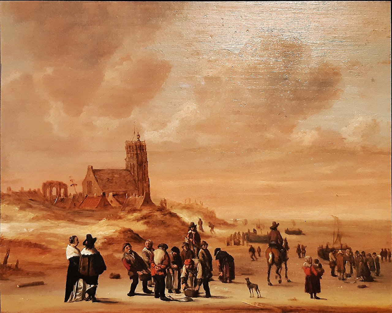
| Cornelis Beelt: The beach at Egmond aan Zee
|
|||||||||||||||||||||||||||
|---|---|---|---|---|---|---|---|---|---|---|---|---|---|---|---|---|---|---|---|---|---|---|---|---|---|---|---|
| Artist |
|
.jpg) | |||||||||||||||||||||||||
| Title |
Ukrainian: Морське узбережжя поблизу Егмонда-аан-Зее The beach at Egmond aan Zee |
||||||||||||||||||||||||||
| Object type |
painting |
||||||||||||||||||||||||||
| Genre |
landscape painting |
||||||||||||||||||||||||||
| Description |
Українська: Морське узбережжя поблизу Егмонда-аан-Зее English: The beach at Egmond aan Zee |
||||||||||||||||||||||||||
| Date | 17th century | ||||||||||||||||||||||||||
| Medium |
oil and plank |
||||||||||||||||||||||||||
| Dimensions |
height: 44.9 cm (17.6 in) |
||||||||||||||||||||||||||
| Collection | Національний музей мистецтв імені Богдана та Варвари Ханенків | ||||||||||||||||||||||||||
| Accession number |
332 ЖК |
||||||||||||||||||||||||||
| Source/Photographer | Own work | ||||||||||||||||||||||||||
| Camera location | | View this and other nearby images on: OpenStreetMap |
|---|
.jpg¶ms=050.434561_N_0030.552756_E_globe:Earth_type:camera_source:exif_&language=en)
Licensing
|
This work is in the public domain in its country of origin and other countries and areas where the copyright term is the author's life plus 100 years or fewer. This work is in the public domain in the United States because it was published (or registered with the U.S. Copyright Office) before January 1, 1931. | |
| This file has been identified as being free of known restrictions under copyright law, including all related and neighboring rights. | |
File history
Click on a date/time to view the file as it appeared at that time.
| Date/Time | Thumbnail | Dimensions | User | Comment | |
|---|---|---|---|---|---|
| current | 21:49, 16 March 2020 | | 4,294 × 3,430 (2.57 MB) | wikimediacommons>Rasal Hague | Uploaded own work with UploadWizard |
File usage
The following page uses this file:
.jpg)