File:AAF-V-map5t.jpg
Jump to navigation
Jump to search
Size of this preview: 767 × 600 pixels. Other resolutions: 307 × 240 pixels | 614 × 480 pixels | 983 × 768 pixels | 1,280 × 1,001 pixels | 1,915 × 1,497 pixels.
Original file (1,915 × 1,497 pixels, file size: 433 KB, MIME type: image/jpeg)
Summary
| Description |
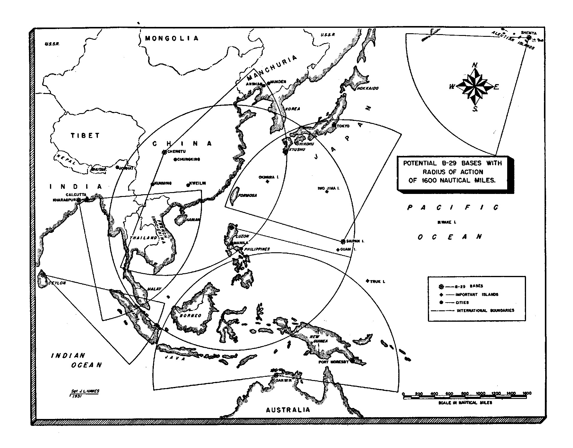
Italiano: Mappa delle potenziali basi dei B-29 con un raggio di azione di 3000 chilometri.
English: Map of potential B-29 bases with radius of action of 1600 nautical miles. |
| Date | Map created in 1951. Book published in 1953. |
| Source | Page 5 of The Pacific: Matterhorn to Nagasaki June 1944 to August 1945 available via https://media.defense.gov/2010/Nov/05/2001329890/-1/-1/0/aaf_wwii-v5-2.pdf |
| Author | Sgt. J.L. Hawes |
Licensing
This image or file is a work of a U.S. Air Force Airman or employee, taken or made as part of that person's official duties. As a work of the U.S. federal government, the image or file is in the public domain in the United States.
|
 |
File history
Click on a date/time to view the file as it appeared at that time.
| Date/Time | Thumbnail | Dimensions | User | Comment | |
|---|---|---|---|---|---|
| current | 22:28, 26 June 2023 | | 1,915 × 1,497 (433 KB) | wikimediacommons>Hawkeye7 | larger |
File usage
The following page uses this file: