File:Alexander Mackenzie map.jpg
Jump to navigation
Jump to search
Original file (5,879 × 4,560 pixels, file size: 9.24 MB, MIME type: image/jpeg)
Summary
| Description |
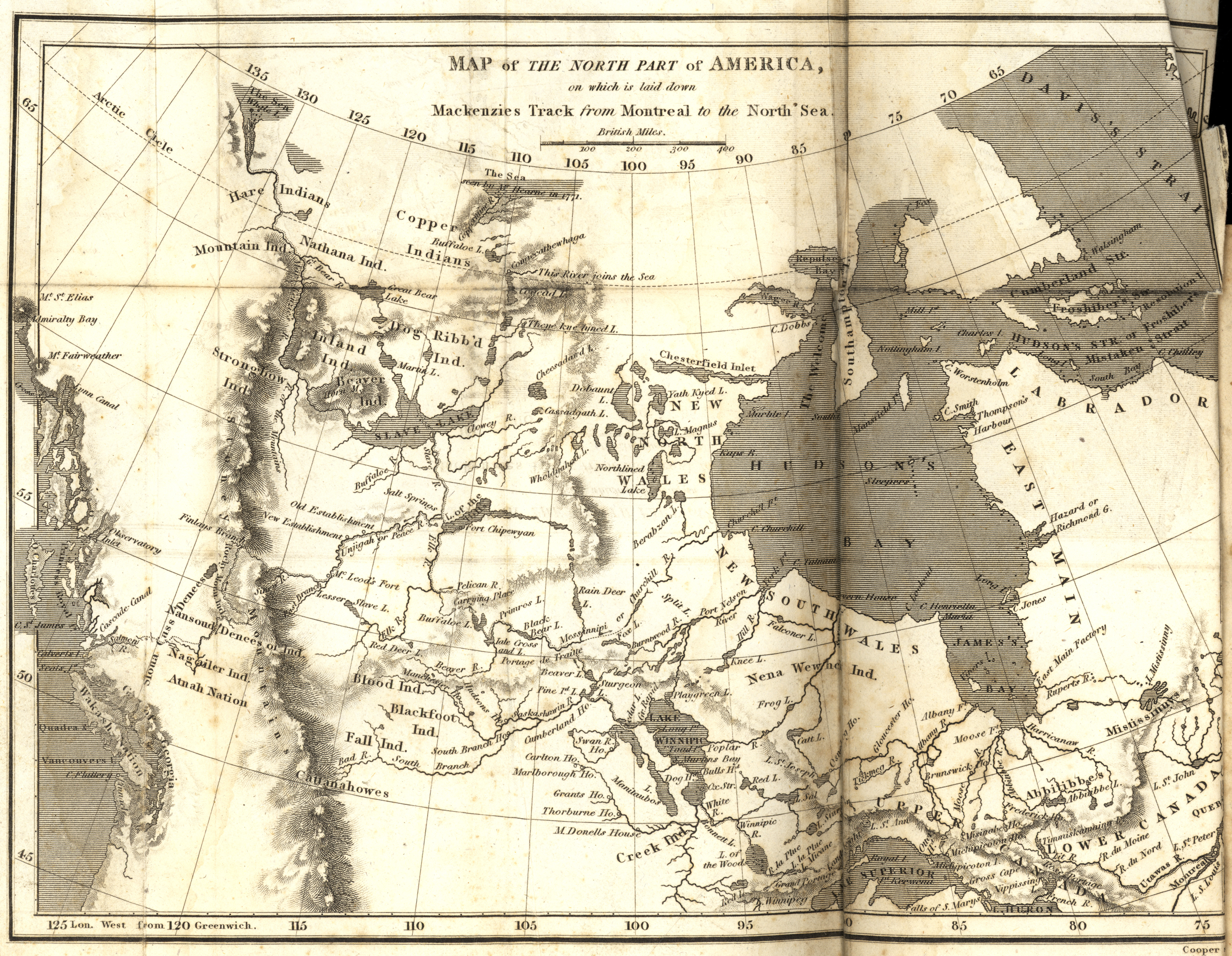
Mackenzie, Alexander. Map of the North Part of America on which is laid down Mackenzies Track (dotted line) from Montreal to the North Sea [map] Scale not given. In: A Collection of Voyages and Travels, from the Discovery of America to the Commencement of the Nineteenth Century (Volume 24). London: 1809. Image Courtesy of University of Manitoba Archives & Special Collections |
| Date | |
| Source | Map of the North Part of America on which is laid down Mackenzies Track from Montreal to the North Sea (1809) |
| Author | Manitoba Historical Maps |
Licensing
This file is licensed under the Creative Commons Attribution 2.0 Generic license.
- You are free:
- to share – to copy, distribute and transmit the work
- to remix – to adapt the work
- Under the following conditions:
- attribution – You must give appropriate credit, provide a link to the license, and indicate if changes were made. You may do so in any reasonable manner, but not in any way that suggests the licensor endorses you or your use.
| This image, originally posted to Flickr, was reviewed on September 14, 2010 by the administrator or reviewer File Upload Bot (Magnus Manske), who confirmed that it was available on Flickr under the stated license on that date. |
File history
Click on a date/time to view the file as it appeared at that time.
| Date/Time | Thumbnail | Dimensions | User | Comment | |
|---|---|---|---|---|---|
| current | 06:19, 14 September 2010 | No thumbnail | 5,879 × 4,560 (9.24 MB) | wikimediacommons>File Upload Bot (Magnus Manske) | {{Information |Description=Mackenzie, Alexander. Map of the North Part of America on which is laid down Mackenzies Track from Montreal to the North Sea [map] Scale not given. In: A Collection of Voyages and Travels, from the Discovery of America to the Co |
File usage
The following page uses this file: