File:Asuncion Island Aerial.jpg
Jump to navigation
Jump to search
No higher resolution available.
Asuncion_Island_Aerial.jpg (432 × 258 pixels, file size: 32 KB, MIME type: image/jpeg)

Summary
| Description |
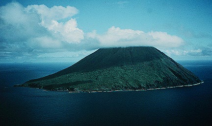
Deutsch: Luftaufnahme der Insel Asuncion in den Nördlichen Marianen
English: Aerial view of Asuncion Island in the Northern Mariana Islands |
| Date | |
| Source | http://volcano.und.nodak.edu/vwdocs/volc_images/southeast_asia/mariana/asuncion.html |
| Author | Frank Trusdell, U.S. Geological Survey |
Licensing

|
This image is in the public domain in the United States because it only contains materials that originally came from the United States Geological Survey, an agency of the United States Department of the Interior. For more information, see the official USGS copyright policy.
|
 |
File history
Click on a date/time to view the file as it appeared at that time.
| Date/Time | Thumbnail | Dimensions | User | Comment | |
|---|---|---|---|---|---|
| current | 07:24, 16 April 2008 | | 432 × 258 (32 KB) | wikimediacommons>Telim tor | == Information == {{Information |Description=Aerial view of Asuncion Island in the Northern Mariana Islands |Source=http://volcano.und.nodak.edu/vwdocs/volc_images/southeast_asia/mariana/asuncion.html |Date=30 April 1994 |Author=Frank Trusdell, U.S. Geolo |
File usage
The following page uses this file:
