File:Balkans2010.png
Jump to navigation
Jump to search

Size of this preview: 650 × 599 pixels. Other resolutions: 260 × 240 pixels | 521 × 480 pixels | 833 × 768 pixels | 1,128 × 1,040 pixels.
Original file (1,128 × 1,040 pixels, file size: 135 KB, MIME type: image/png)
Summary
| Description |
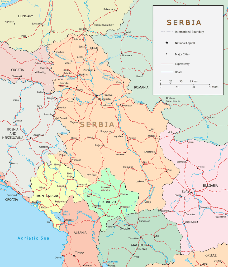
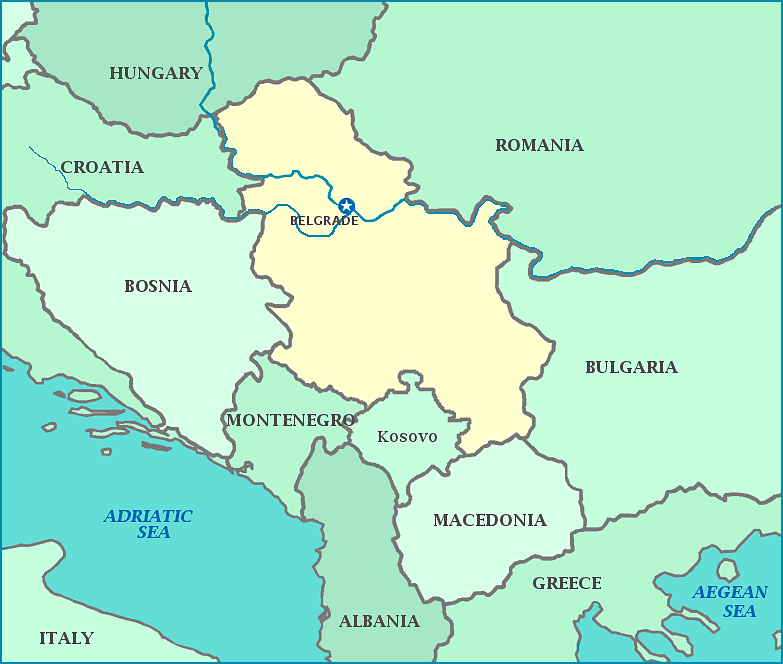
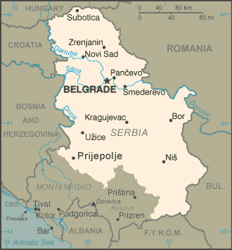
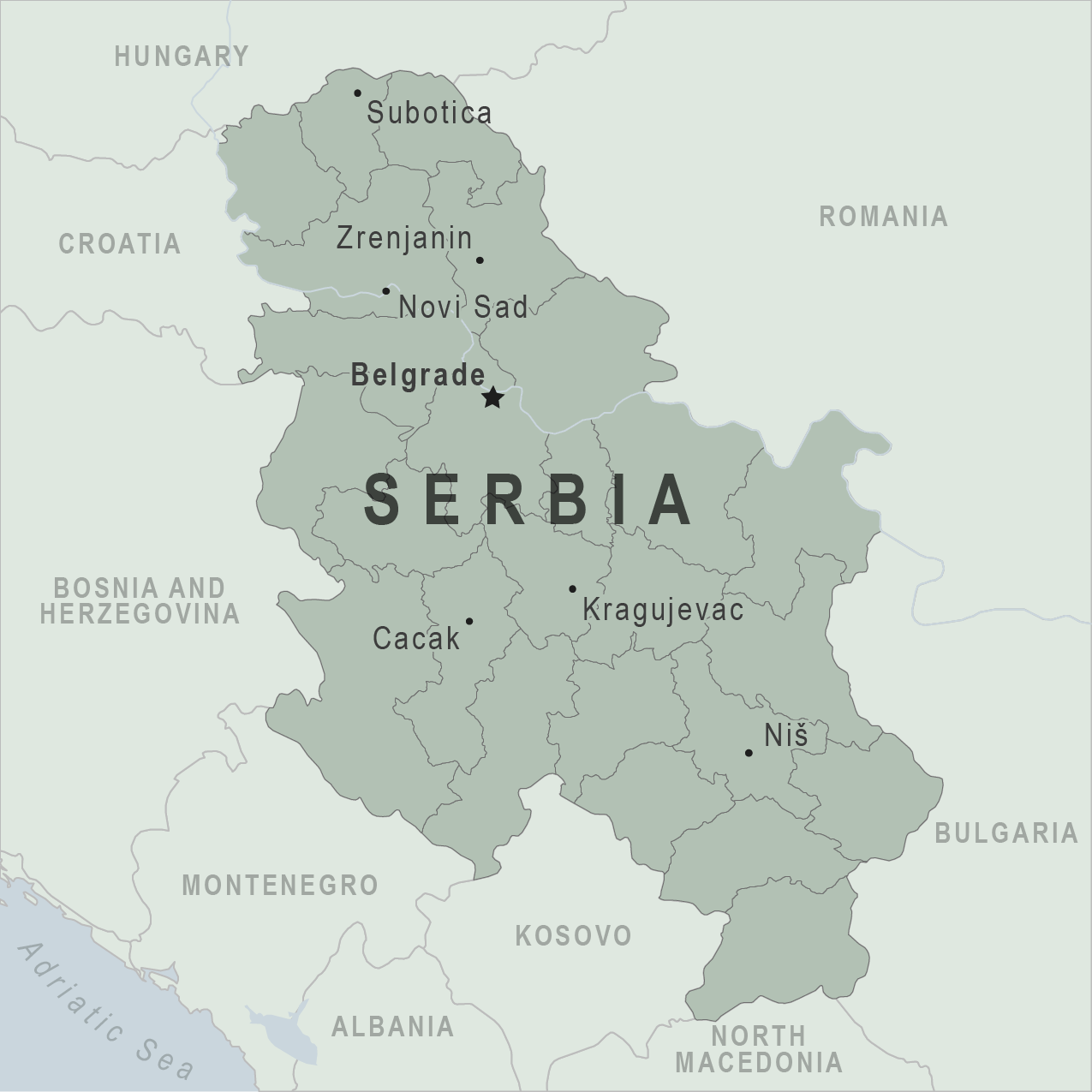
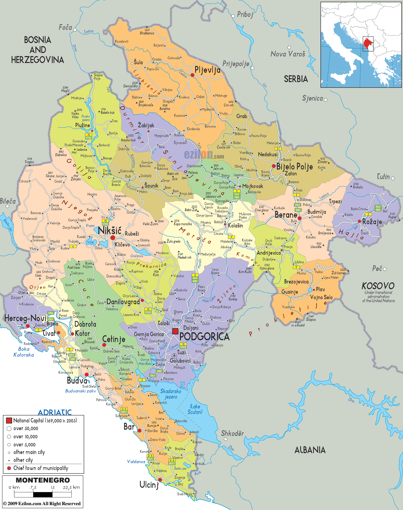
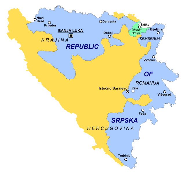
English: Map of Central Balkans in 2010 - showing Bosnia and Herzegovina, Serbia, Montenegro and Kosovo. |
| Date | |
| Source | Own work |
| Author | WikiEditor2004 |

|
This map image could be re-created using vector graphics as an SVG file. This has several advantages; see Commons:Media for cleanup for more information. If an SVG form of this image is available, please upload it and afterwards replace this template with
{{vector version available|new image name}}.It is recommended to name the SVG file “Balkans2010.svg”—then the template Vector version available (or Vva) does not need the new image name parameter. |
Licensing
I, the copyright holder of this work, hereby publish it under the following license:
| This file is made available under the Creative Commons CC0 1.0 Universal Public Domain Dedication. | |
| The person who associated a work with this deed has dedicated the work to the public domain by waiving all of their rights to the work worldwide under copyright law, including all related and neighboring rights, to the extent allowed by law. You can copy, modify, distribute and perform the work, even for commercial purposes, all without asking permission.
|
References
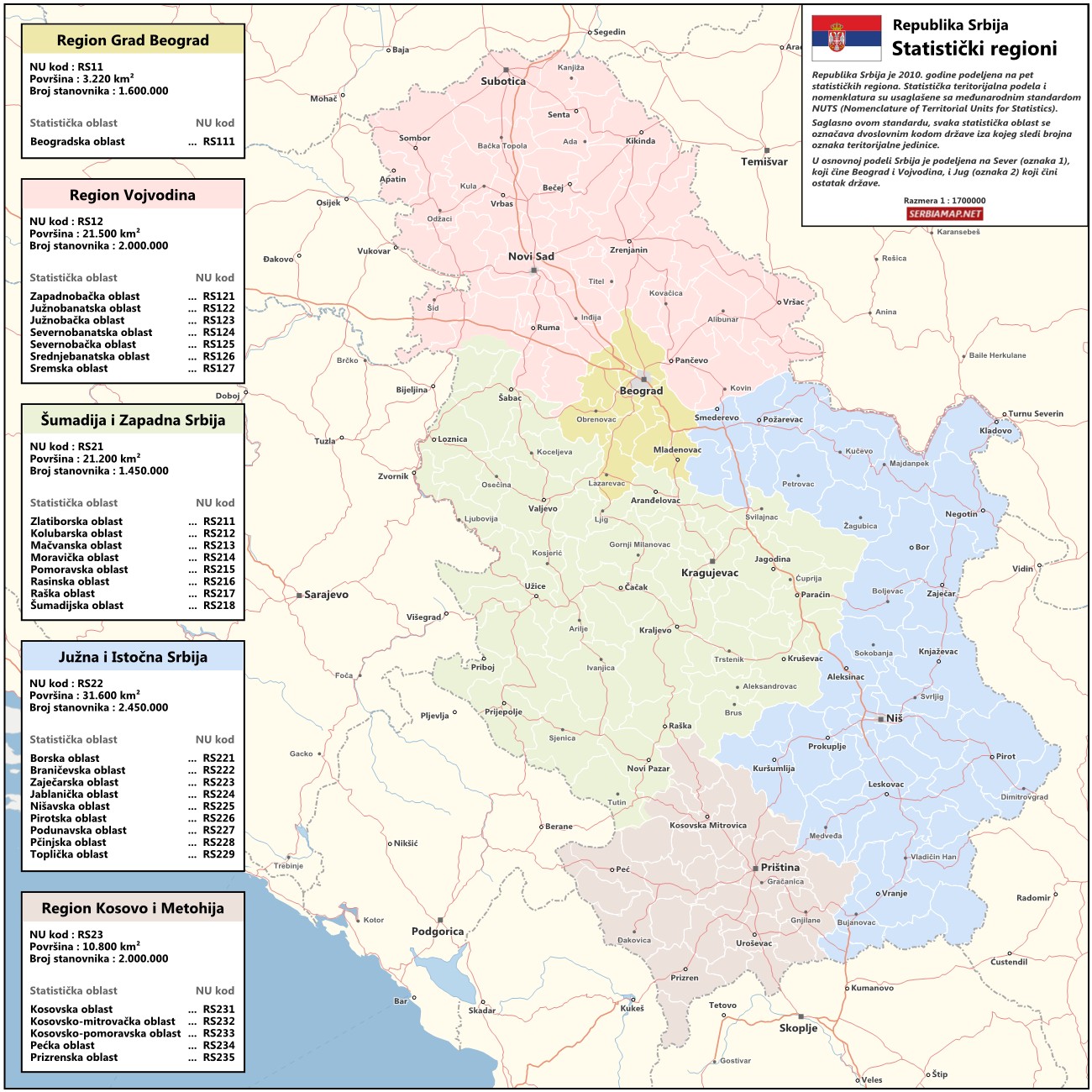
- http://www.novosti.rs/upload/images/2010/07%20jul/1207/pol-Pet_Oblasti.jpg[dead link]
- http://www.serbiamap.net/maps/mapa-srbija-statisticki-regioni.jpg
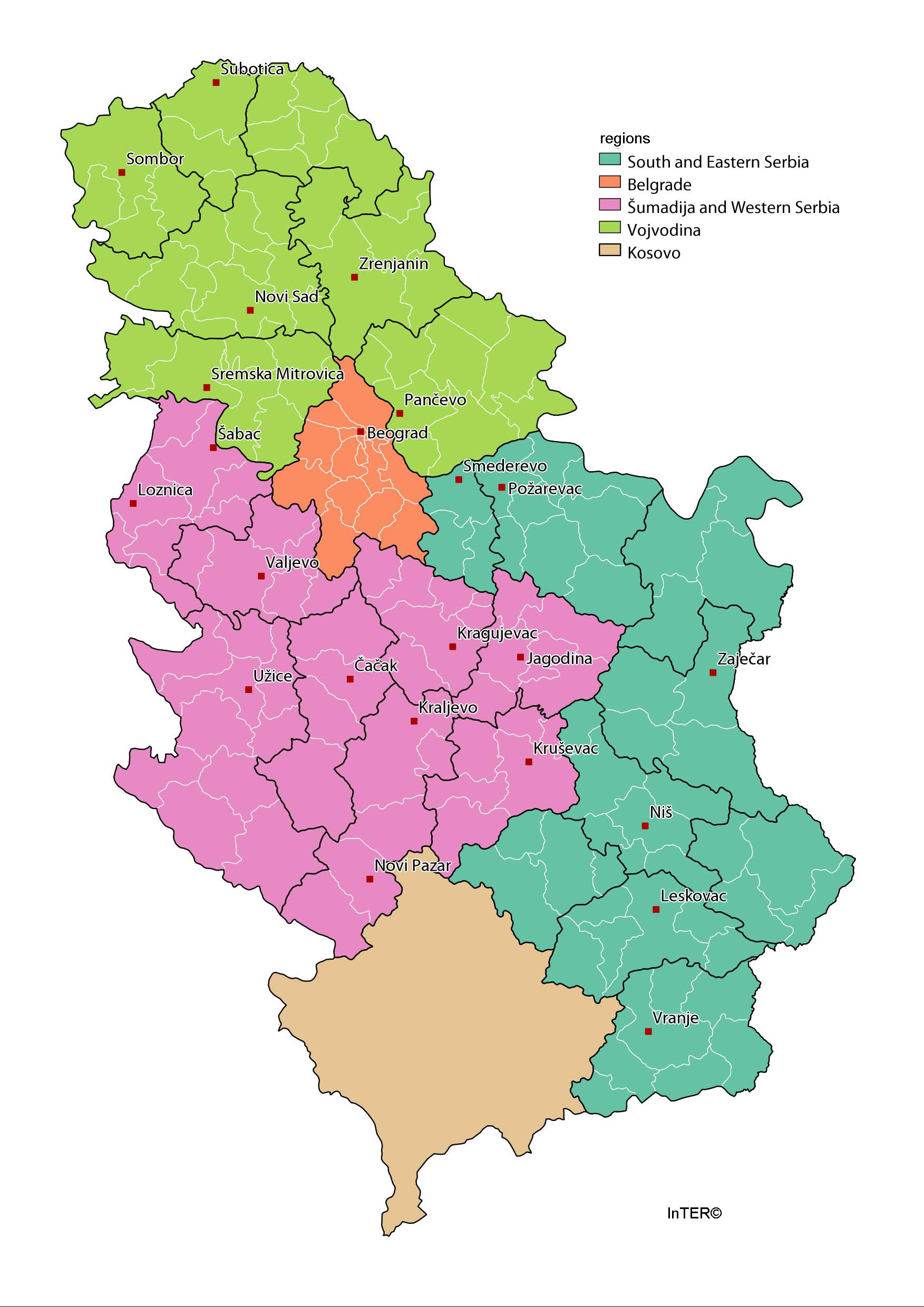
- http://www.lokalnirazvoj.org/upload/Book/Image/2012_03/Regions_and_Cities.jpg
- http://www.danas.rs/upload/images/news/2010/2/3/1001_ocp_w222_h313.jpg[dead link]
- http://www.novosti.rs/upload/images/2010/03mar/1203/pol-regioni.jpg[dead link]
- http://static.politika.co.rs/uploads/rubrike/122239/i/1/Untitled-1.jpg[dead link]
- http://www.geographicguide.com/pictures/maps/servia.gif
- http://www.yourchildlearns.com/online-atlas/images/serbia_map.gif
- http://www.smartraveller.gov.au/zwiki/pub/Maps/countries/dfat/Serbia.jpg archive copy at the Wayback Machine
- http://www.zofona.com/images/log84.gif
- http://www.zofona.com/images/log84.gif
- http://wwwnc.cdc.gov/travel/images/map-serbia.png
- http://i.istockimg.com/file_thumbview_approve/18192921/2/stock-illustration-18192921-serbia-vector-map.jpg[dead link]
- http://upload.wikimedia.org/wikipedia/commons/3/37/Kosovo-map.gif
- http://www.smartraveller.gov.au/zwiki/pub/Maps/countries/dfat/Kosovo.jpg archive copy at the Wayback Machine
- http://thumbs.dreamstime.com/thumblarge_374/1236878946ycZqnP.jpg[dead link]
- http://www.lonelyplanet.com/maps/europe/montenegro/map_of_montenegro.jpg
- http://www.i-google-map.com/gfx/maps/big/mj-map.gif[dead link]
- http://www.ezilon.com/maps/images/europe/Montenegro-political-map.gif
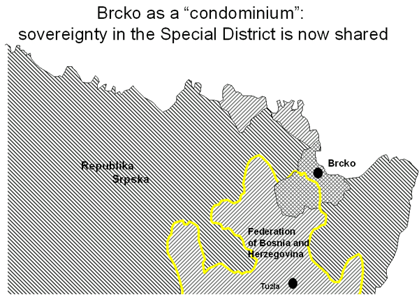
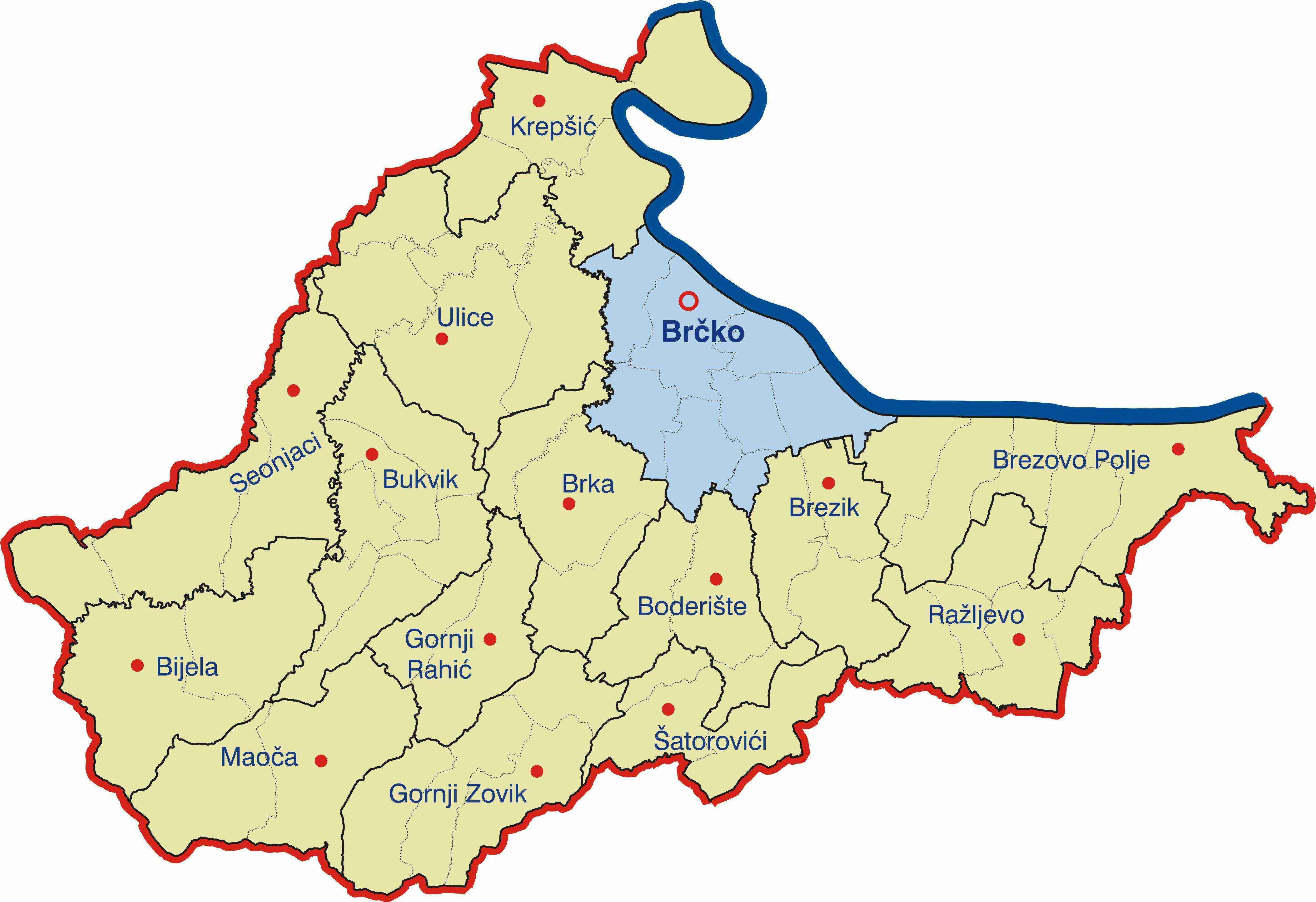
- http://www.ohr.int/ohr-offices/brcko/gen-info/images/brcko-chart-2.gif
- http://bih-x.info/wp-content/uploads/2010/03/Brcko-Distrikt.jpg
- http://www.conflictgeographies.org/uploads/2/6/1/8/2618869/8958714.jpg?490 archive copy at the Wayback Machine
- http://whoruleswhere.files.wordpress.com/2010/10/631px-republika_srpska_simple-svg.png
- United States Department of State
File history
Click on a date/time to view the file as it appeared at that time.
| Date/Time | Thumbnail | Dimensions | User | Comment | |
|---|---|---|---|---|---|
| current | 21:22, 26 August 2021 | | 1,128 × 1,040 (135 KB) | wikimediacommons>Santasa99 | more npov colors & labels |
File usage
The following page uses this file: