File:Beaver wars map.jpg
Jump to navigation
Jump to search
Size of this preview: 710 × 600 pixels. Other resolutions: 284 × 240 pixels | 568 × 480 pixels | 871 × 736 pixels.
Original file (871 × 736 pixels, file size: 163 KB, MIME type: image/jpeg)
| Description |
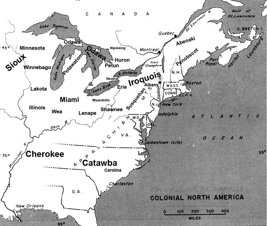
English: Map of the location of major tribes involved in the Beaver Wars laid against a period map showing colonial settlments |
||
| Date | |||
| Source | Own work | ||
| Author | Charles Edward | ||
| Permission (Reusing this file) |
|
Info
This represents the approximate configuration of the tribes in 1648. Although the areas are large, the populations were low and large parts of the territories where uninhabited, and instead used as hunting grounds. The tribes were also semi nomadic, and the period was rife with war and several of the tribes on the map were destroyed in the 1650s. The map was made using information in several books incluing:
- Jennings, Francis (1984) The Ambiguous Iroquois Empire ISBN: 0393017192.
- Wallace, Paula W (2007) Indians in Pennsylvania, DIANE Publishing Inc ISBN: 1422314936.
File history
Click on a date/time to view the file as it appeared at that time.
| Date/Time | Thumbnail | Dimensions | User | Comment | |
|---|---|---|---|---|---|
| current | 22:34, 18 November 2008 | | 871 × 736 (163 KB) | wikimediacommons>Charles Edward | Slight adjustment to name on image |
File usage
The following page uses this file: