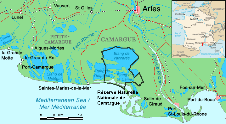
File:Camargue map.png
Jump to navigation
Jump to search
No higher resolution available.
Camargue_map.png (718 × 396 pixels, file size: 42 KB, MIME type: image/png)
Summary
| Description | ||||
| Date | ||||
| Source | Combination of CIA World Factbook map (Image:Fr-map.png) and Demis Map Server (http://www2.demis.nl/mapserver/mapper.asp) data with additional annotations and modifications by self. | |||
| Author | ChrisO | |||
| Other versions |
File:Camargue, Petite Caramgue et Parc naturel reg.png (relaunched and actualized)
|

File history
Click on a date/time to view the file as it appeared at that time.
| Date/Time | Thumbnail | Dimensions | User | Comment | |
|---|---|---|---|---|---|
| current | 21:34, 29 April 2016 | | 718 × 396 (42 KB) | wikimediacommons>Rsuessbr | Writing of Petite-Camargue corrected |
File usage
The following page uses this file: