File:Carte maine.svg
Jump to navigation
Jump to search

Size of this PNG preview of this SVG file: 800 × 554 pixels. Other resolutions: 320 × 222 pixels | 640 × 443 pixels | 1,024 × 709 pixels | 1,280 × 886 pixels | 2,560 × 1,772 pixels | 1,813 × 1,255 pixels.
Original file (SVG file, nominally 1,813 × 1,255 pixels, file size: 3.76 MB)
Summary
| Description |
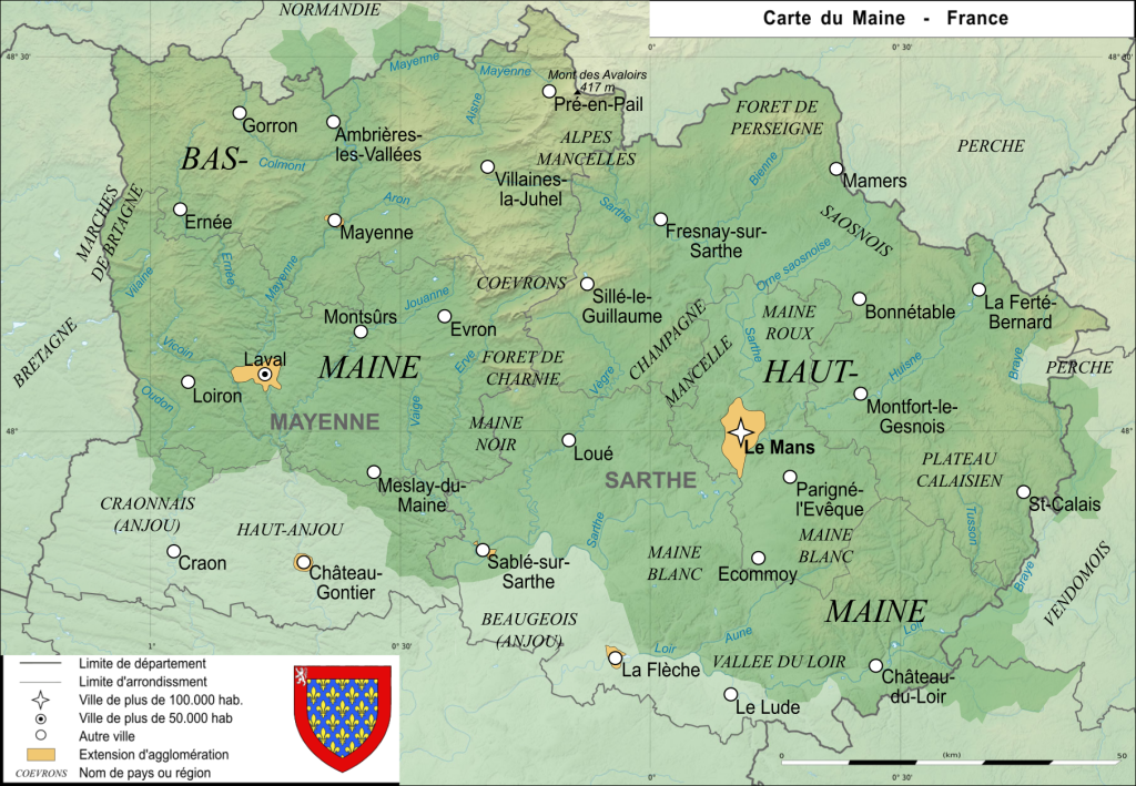
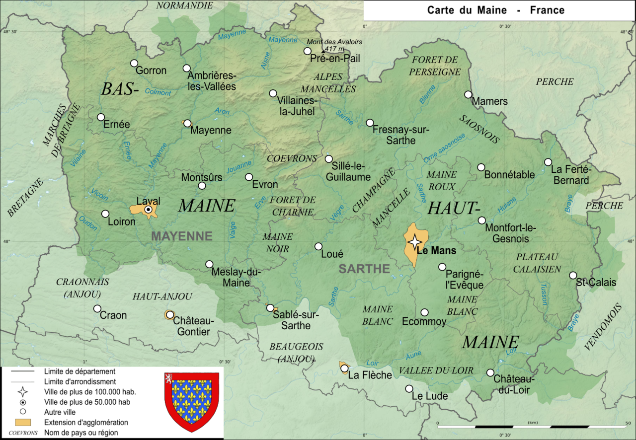
Carte de l'ancienne province française du Maine Map of the ancient french province Maine |
| Date | |
| Source | Own work |
| Author | User:Esprit04 |
Licensing
| I, the copyright holder of this work, release this work into the public domain. This applies worldwide. In some countries this may not be legally possible; if so: I grant anyone the right to use this work for any purpose, without any conditions, unless such conditions are required by law. |
File history
Click on a date/time to view the file as it appeared at that time.
| Date/Time | Thumbnail | Dimensions | User | Comment | |
|---|---|---|---|---|---|
| current | 12:27, 20 August 2021 | | 1,813 × 1,255 (3.76 MB) | wikimediacommons>Esprit04 | limites |
File usage
The following page uses this file: