File:Cessions Southeastern Tribes- Andrew Jackson.jpg
Jump to navigation
Jump to search

Size of this preview: 800 × 596 pixels. Other resolutions: 320 × 238 pixels | 640 × 477 pixels | 1,024 × 763 pixels | 1,280 × 953 pixels | 2,030 × 1,512 pixels.
Original file (2,030 × 1,512 pixels, file size: 633 KB, MIME type: image/jpeg)
Summary
| Description |
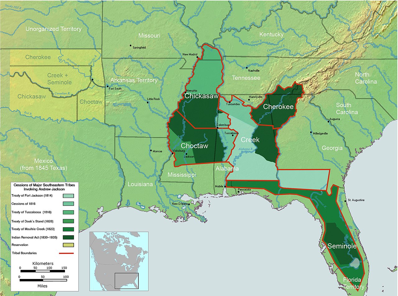
English: Map cessions of the Five Southeastern tribes in which Andrew Jackson was an agent.
Image does not include Creek cessions to the state of Georgia or the Cherokee cessions previous to 1835 as these did not involve Andrew Jackson. Color choices guided by Wikipedia accessibility guidelines, Area colors for cessions were chosen from 9-class color-blind friendly sequential set in [1]. Result tested using Coblinder. |
| Date | |
| Source |
Own work based on: Trails of Tears en.png
References:
|
| Author | Wtfiv |

Licensing
I, the copyright holder of this work, hereby publish it under the following license:
This file is licensed under the Creative Commons Attribution-Share Alike 4.0 International license.
- You are free:
- to share – to copy, distribute and transmit the work
- to remix – to adapt the work
- Under the following conditions:
- attribution – You must give appropriate credit, provide a link to the license, and indicate if changes were made. You may do so in any reasonable manner, but not in any way that suggests the licensor endorses you or your use.
- share alike – If you remix, transform, or build upon the material, you must distribute your contributions under the same or compatible license as the original.
| Annotations | This image is annotated: View the annotations at Commons |
File history
Click on a date/time to view the file as it appeared at that time.
| Date/Time | Thumbnail | Dimensions | User | Comment | |
|---|---|---|---|---|---|
| current | 21:42, 1 September 2024 | | 2,030 × 1,512 (633 KB) | wikimediacommons>Wtfiv | Removed Treaty of Moultrie from list- Jackson made it possible but didn't negotiate it. |
File usage
The following page uses this file: