File:Cook New Zealand South Cape.jpg
Jump to navigation
Jump to search
Size of this preview: 776 × 599 pixels. Other resolutions: 311 × 240 pixels | 622 × 480 pixels.
Original file (800 × 618 pixels, file size: 127 KB, MIME type: image/jpeg)
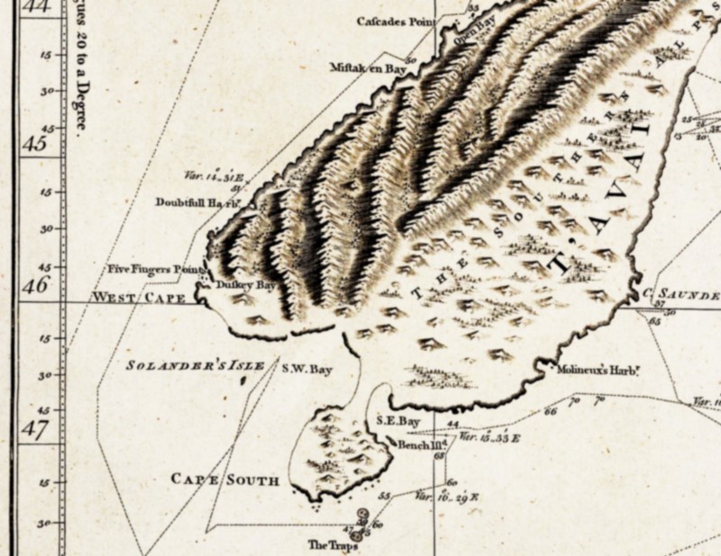
| Description | South-eastern part of the first complete map of New Zealand, drawn by James Cook. Cook believed that Stewart Island was connected to the South Island and thus named it South Cape. |
| Date | between 1769 and 1770 |
| Source | National Maritime Museum, London. Collections Online, Repro-ID: F0293 |
| Author |
"explored by Lieut. I. Cook, Commander of His Majesty's Bark Endeavour |
| Other versions |
another version of Cook's map of all New Zealand: Image:Cook new zealand.jpg; |
|
This work is in the public domain in its country of origin and other countries and areas where the copyright term is the author's life plus 100 years or fewer. | |
| This file has been identified as being free of known restrictions under copyright law, including all related and neighboring rights. | |
File history
Click on a date/time to view the file as it appeared at that time.
| Date/Time | Thumbnail | Dimensions | User | Comment | |
|---|---|---|---|---|---|
| current | 14:59, 15 April 2007 | | 800 × 618 (127 KB) | wikimediacommons>Ibn Battuta | higher resolution of (another version of) Cook's map |
File usage
The following page uses this file: