File:Europe-blocs-49-89x4.svg
Jump to navigation
Jump to search

Size of this PNG preview of this SVG file: 800 × 501 pixels. Other resolutions: 320 × 201 pixels | 640 × 401 pixels | 1,024 × 642 pixels | 1,280 × 802 pixels | 2,560 × 1,605 pixels | 812 × 509 pixels.
Original file (SVG file, nominally 812 × 509 pixels, file size: 237 KB)
Summary
| Description |
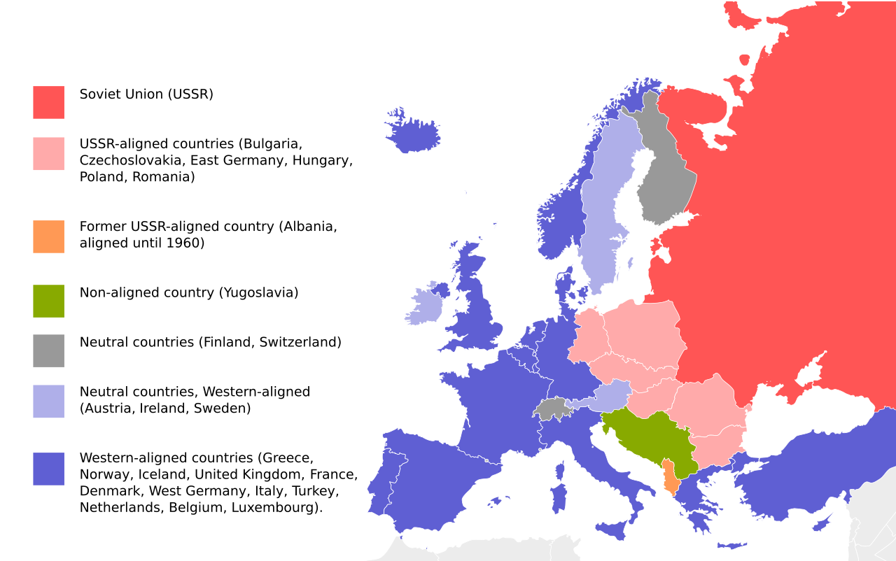
English: Cold War map of Eastern and Western Blocs in Europe. Map based on File:EU27-further_enlargement_map.svg |
| Date | |
| Source | File:EU27-further_enlargement_map.svg |
| Author | User:Goldsztajn |
| Other versions |
[]
|


Licensing
| I, the copyright holder of this work, release this work into the public domain. This applies worldwide. In some countries this may not be legally possible; if so: I grant anyone the right to use this work for any purpose, without any conditions, unless such conditions are required by law. |
File history
Click on a date/time to view the file as it appeared at that time.
| Date/Time | Thumbnail | Dimensions | User | Comment | |
|---|---|---|---|---|---|
| current | 13:13, 1 December 2025 | | 812 × 509 (237 KB) | wikimediacommons>Assadzadeh | Reverted to version as of 14:31, 27 November 2025 (UTC) As I've explained before, the legend for the previous version is missing some of the countries. Please engage in the discussion. |
File usage
The following 4 pages use this file: