File:Europe map 1919.jpg
Jump to navigation
Jump to search

Size of this preview: 800 × 600 pixels. Other resolutions: 320 × 240 pixels | 640 × 480 pixels | 1,024 × 768 pixels | 1,280 × 960 pixels | 1,920 × 1,440 pixels.
Original file (1,920 × 1,440 pixels, file size: 1.41 MB, MIME type: image/jpeg)
Summary
| Description |
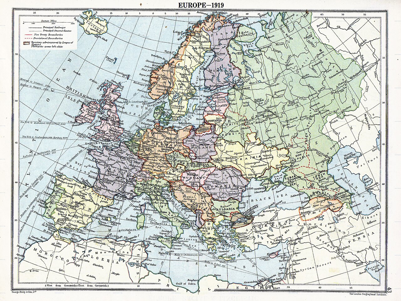
English: Map of en:Europe political divisions in 1919 (after the treaties of Brest-Litovsk and Versailles and before the treaties of Trianon, Riga, Kars and the establishment of en:Soviet Union and the republics of Ireland and Turkey) published by London Geographical Institute.
This uploaded map is a photoshopped version of the original image located at hipkiss.org. According to the site, there are no copyrights to this map. |
| Source | |
| Author | |
| Other versions | Derivative works of this file: Europe map 1919 cropped.JPG |
_en.png)
.png)
.jpg)
Licensing
This media file is in the public domain in the United States. This applies to U.S. works where the copyright has expired, often because its first publication occurred prior to January 1, 1931, and if not then due to lack of notice or renewal. See this page for further explanation.
|
 | |
 |
Original upload log
The original description page was here. All following user names refer to en.wikipedia.
- 2007-11-03 20:09 MaGioZal 1996×1506×8 (1457003 bytes) Map of [[Europe]] political divisions in 1919 (after the treaties of [[Treaty_of_Brest-Litovsk|Brest-Livotsk]] and [[Treaty of Versailles|Versailles]] and before the [[Treaty of Riga]] and the creation of [[Soviet Union]]) published by London Geographical
File history
Click on a date/time to view the file as it appeared at that time.
| Date/Time | Thumbnail | Dimensions | User | Comment | |
|---|---|---|---|---|---|
| current | 05:41, 7 August 2023 | | 1,920 × 1,440 (1.41 MB) | wikimediacommons>User-duck | Cropped to reduce border using CropTool with lossless mode. |
File usage
The following 3 pages use this file: