File:Europe map 220BC.PNG
Jump to navigation
Jump to search
Size of this preview: 628 × 599 pixels. Other resolutions: 251 × 240 pixels | 503 × 480 pixels | 805 × 768 pixels | 1,143 × 1,091 pixels.
Original file (1,143 × 1,091 pixels, file size: 77 KB, MIME type: image/png)
Summary
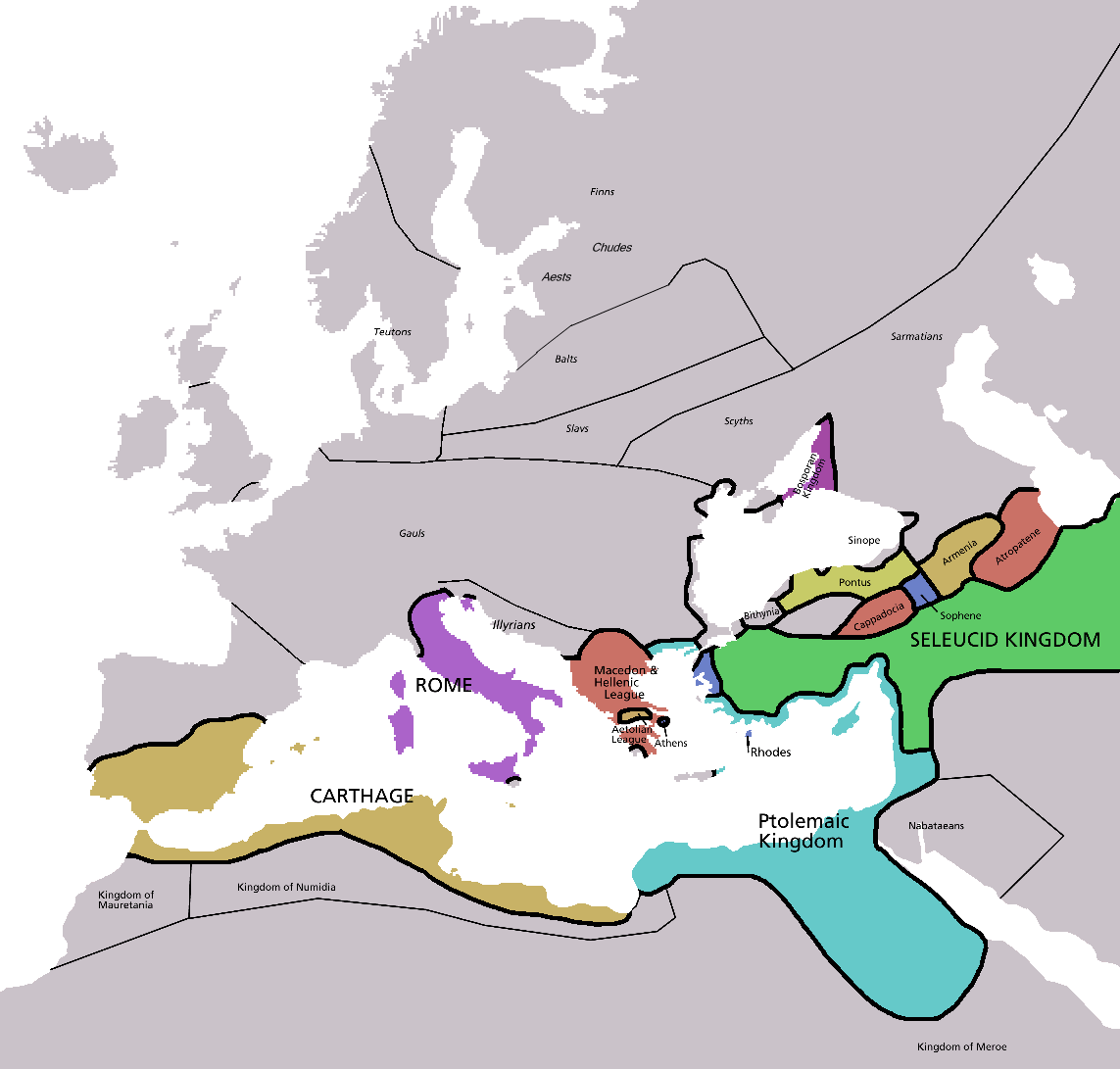
| Description | Map of Europe in 220BC, based on free map of europe Image:BlankMap-Europe.png. Many of the border lines are approximations. |
| Date | |
| Source | The Penguin Atlas of Ancient History |
| Author | Astrokey44 |
| Other versions | map without text, map in french |

|
This historical map image could be re-created using vector graphics as an SVG file. This has several advantages; see Commons:Media for cleanup for more information. If an SVG form of this image is available, please upload it and afterwards replace this template with
{{vector version available|new image name}}.It is recommended to name the SVG file “Europe map 220BC.svg”—then the template Vector version available (or Vva) does not need the new image name parameter. |
_en.png)
.png)
.jpg)
Licensing

|
Permission is granted to copy, distribute and/or modify this document under the terms of the GNU Free Documentation License, Version 1.2 or any later version published by the Free Software Foundation; with no Invariant Sections, no Front-Cover Texts, and no Back-Cover Texts. A copy of the license is included in the section entitled GNU Free Documentation License. |
| This file is licensed under the Creative Commons Attribution-Share Alike 3.0 Unported license. | ||
| ||
| This licensing tag was added to this file as part of the GFDL licensing update. |
File history
Click on a date/time to view the file as it appeared at that time.
| Date/Time | Thumbnail | Dimensions | User | Comment | |
|---|---|---|---|---|---|
| current | 05:28, 8 February 2011 | | 1,143 × 1,091 (77 KB) | wikimediacommons>Swarm | Correcting borders of Rome |
File usage
The following 2 pages use this file: