File:Gedrosia-Map-Route-of-Alexander-1823-Lucas.png
Jump to navigation
Jump to search
Size of this preview: 596 × 600 pixels. Other resolutions: 239 × 240 pixels | 477 × 480 pixels | 656 × 660 pixels.
Original file (656 × 660 pixels, file size: 881 KB, MIME type: image/png)
Summary
| Description |
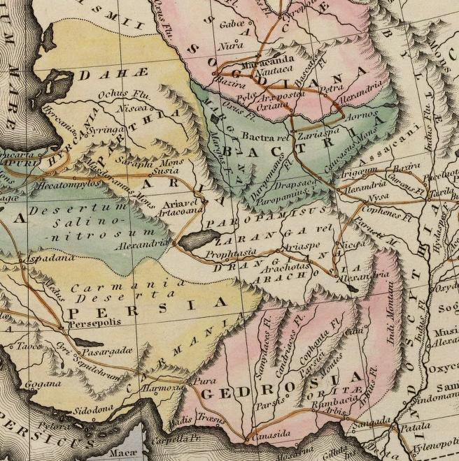
Map of the route of Alexander the Great in South Asia,
|
||||||||||||||||||||
| Date | |||||||||||||||||||||
| Source | scanned from Plate 12 of A general atlas containing distinct maps of all the known countries in the world by Fielding Lucas | ||||||||||||||||||||
| Author |
engraved by J. Yeager; published by
|
||||||||||||||||||||
| Permission (Reusing this file) |
Public Domain | ||||||||||||||||||||

Licensing
|
This is a faithful photographic reproduction of a two-dimensional, public domain work of art. The work of art itself is in the public domain for the following reason:
The official position taken by the Wikimedia Foundation is that "faithful reproductions of two-dimensional public domain works of art are public domain".
This photographic reproduction is therefore also considered to be in the public domain in the United States. In other jurisdictions, re-use of this content may be restricted; see Reuse of PD-Art photographs for details. | ||||
File history
Click on a date/time to view the file as it appeared at that time.
| Date/Time | Thumbnail | Dimensions | User | Comment | |
|---|---|---|---|---|---|
| current | 17:51, 29 November 2007 | | 656 × 660 (881 KB) | wikimediacommons>Bejnar | {{Information |Description=Map of the route of Alexander the Great through Gedrosia, Bactria, and Sogdiana part of a map entitled "Alexandri Magni Itinera" based upon Melish (1815) ''Atlas of Ancient Geography'' |Source= scanned from Plate 12 of ''A gener |
File usage
The following page uses this file: