File:Geologic map of Long Valley and Mono Basin region (USGS).png
Jump to navigation
Jump to search
No higher resolution available.
Geologic_map_of_Long_Valley_and_Mono_Basin_region_(USGS).png (300 × 325 pixels, file size: 10 KB, MIME type: image/png)
.png)
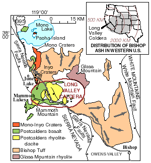
| Description | Geologic map of Long Valley and Mono Basin region | |||
| Date | ||||
| Source | Archived source link | |||
| Author | United States Geological Survey | |||
| Permission (Reusing this file) |
|
File history
Click on a date/time to view the file as it appeared at that time.
| Date/Time | Thumbnail | Dimensions | User | Comment | |
|---|---|---|---|---|---|
| current | 04:31, 20 March 2011 | | 300 × 325 (10 KB) | wikimediacommons>Hike395 | higher resolution original |
File usage
The following page uses this file:
.png)