File:Great Salt Lake Map.jpg
Jump to navigation
Jump to search
Original file (4,320 × 4,320 pixels, file size: 3.88 MB, MIME type: image/jpeg)
Summary
| Description |
English: Map of the Great Salt Lake, Utah, United States showing predominant features. |
||
| Date | |||
| Source | This map was entirely self made using ArcGIS. Map data is from Utah AGRC, ESRI and the USGS. | ||
| Author | Justinmorris (talk) | ||
| Permission (Reusing this file) |
|

|
This map image could be re-created using vector graphics as an SVG file. This has several advantages; see Commons:Media for cleanup for more information. If an SVG form of this image is available, please upload it and afterwards replace this template with
{{vector version available|new image name}}.It is recommended to name the SVG file “Great Salt Lake Map.svg”—then the template Vector version available (or Vva) does not need the new image name parameter. |


Licensing
Justinmorris at English Wikipedia, the copyright holder of this work, hereby publishes it under the following license:
This file is licensed under the Creative Commons Attribution-Share Alike 3.0 Unported license.
Attribution:
- You are free:
- to share – to copy, distribute and transmit the work
- to remix – to adapt the work
- Under the following conditions:
- attribution – You must give appropriate credit, provide a link to the license, and indicate if changes were made. You may do so in any reasonable manner, but not in any way that suggests the licensor endorses you or your use.
- share alike – If you remix, transform, or build upon the material, you must distribute your contributions under the same or compatible license as the original.
Original upload log
The original description page was here. All following user names refer to en.wikipedia.
| Date/Time | Dimensions | User | Comment |
|---|---|---|---|
| 2008-12-16 18:52 | 4320×4320× (4067358 bytes) | Justinmorris | == Summary == {{Information |Description=Map of [[w:Great Salt Lake|the Great Salt Lake]], Utah, United States showing predominant features. |Source= {{User:Justinmorris/Source}} |Date=Tuesday, December 16, 2008 |Location=[[Antelope Island]] |Author=[[Use |
File history
Click on a date/time to view the file as it appeared at that time.
| Date/Time | Thumbnail | Dimensions | User | Comment | |
|---|---|---|---|---|---|
| current | 13:06, 12 December 2015 | 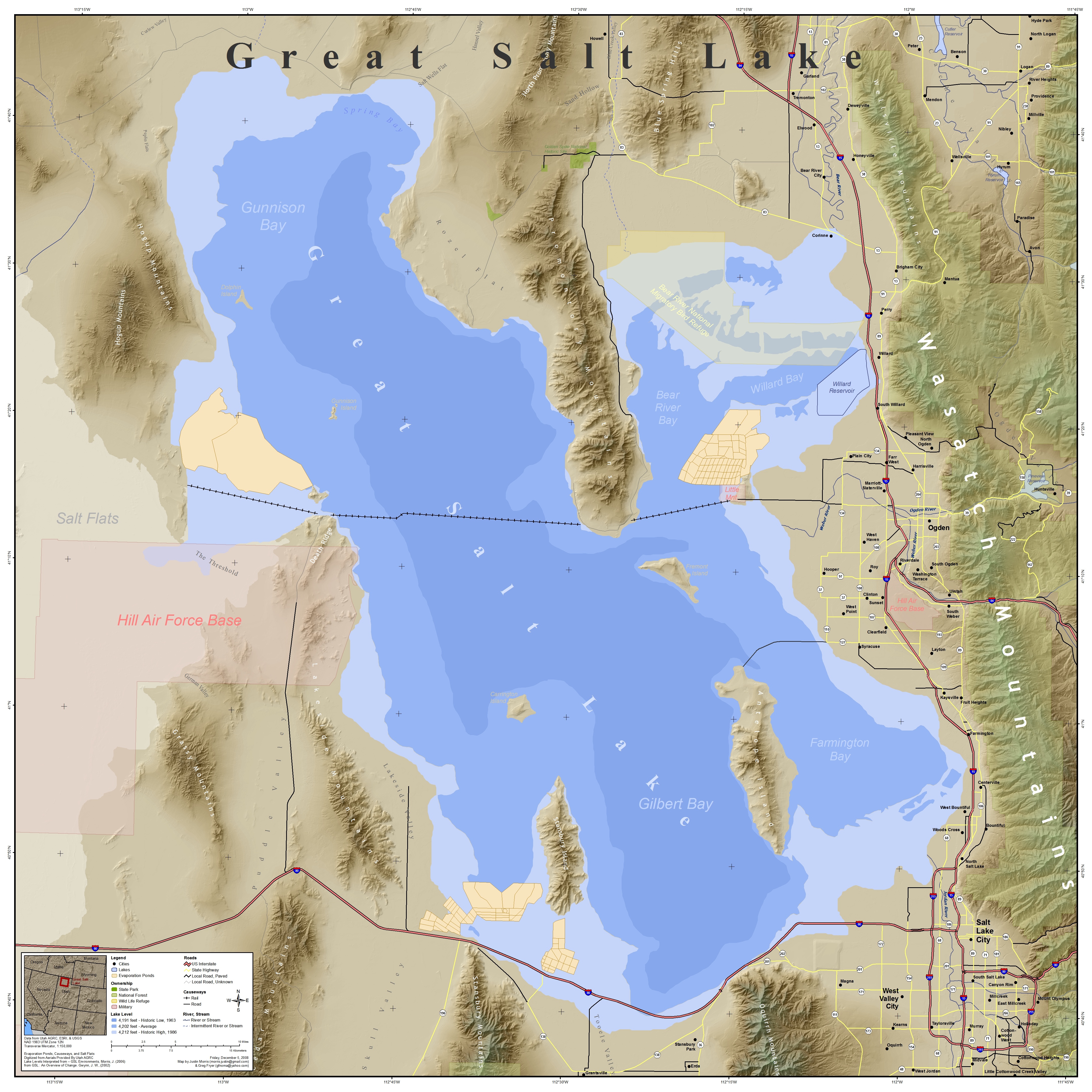 | 4,320 × 4,320 (3.88 MB) | wikimediacommons>Moheen | Transferred from en.wikipedia |
File usage
The following 2 pages use this file: