File:ISS020-E-026195 Aorounga Impact Crater Chad.jpg
Original file (4,256 × 2,832 pixels, file size: 10.64 MB, MIME type: image/jpeg)
Summary
| Description |
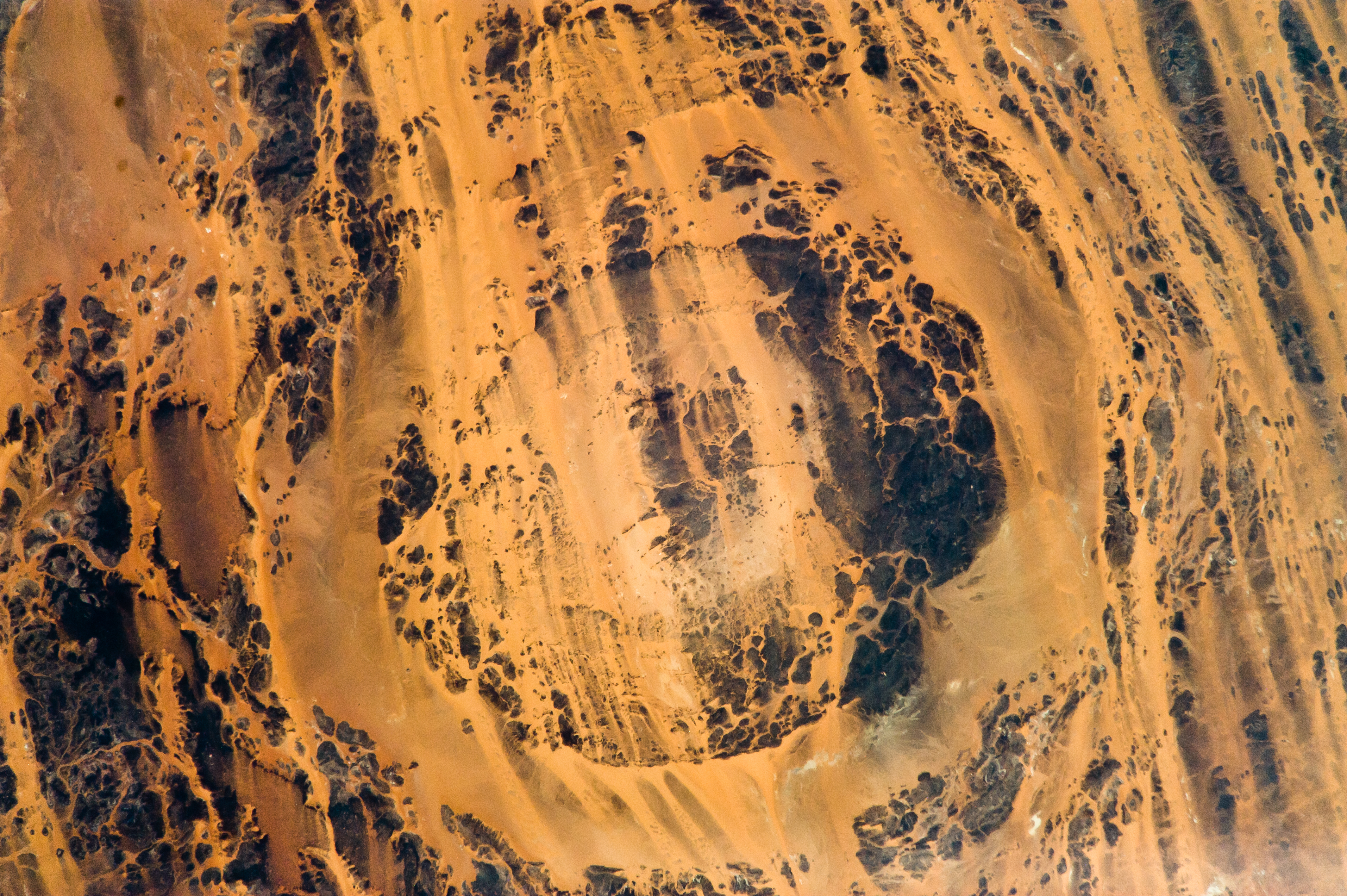
English: The concentric ring structure of the Aorounga crater—renamed Aorounga South in the multiple-crater interpretation of SIR data—is clearly visible in this detailed astronaut photograph. The central highland, or peak, of the crater is surrounded by a small sand-filled trough; this in turn is surrounded by a larger circular trough. Linear rock ridges alternating with light orange sand deposits cross the image from upper left to lower right; these are called yardangs by geomorphologists. Yardangs form by wind erosion of exposed rock layers in a unidirectional wind field. The wind blows from the northeast at Aorounga, and sand dunes formed between the yardangs are actively migrating to the southwest.
|
||||||||||||||||||||||||||||||||||||||||||||||||||||||
| Date | |||||||||||||||||||||||||||||||||||||||||||||||||||||||
| Source | ISS020-E-26195 | ||||||||||||||||||||||||||||||||||||||||||||||||||||||
| Author |
|
||||||||||||||||||||||||||||||||||||||||||||||||||||||
| Other versions |
|
||||||||||||||||||||||||||||||||||||||||||||||||||||||


| Object location |  | View this and other nearby images on: OpenStreetMap |  |
|---|

| Camera location | | View this and other nearby images on: OpenStreetMap | |
|---|


|
This image or video was catalogued by Lyndon B. Johnson Space Center of the United States National Aeronautics and Space Administration (NASA) under Photo ID: ISS020-E-026195. This tag does not indicate the copyright status of the attached work. A normal copyright tag is still required. See Commons:Licensing. Other languages:
|
Licensing

|
This file is in the public domain in the United States because it was solely created by NASA. NASA copyright policy states that "NASA material is not protected by copyright unless noted". (See Template:PD-USGov, NASA copyright policy page or JPL Image Use Policy.) |  |
 |
Warnings:
|

File history
Click on a date/time to view the file as it appeared at that time.
| Date/Time | Thumbnail | Dimensions | User | Comment | |
|---|---|---|---|---|---|
| current | 11:56, 29 March 2013 | | 4,256 × 2,832 (10.64 MB) | wikimediacommons>Julian Herzog | User created page with UploadWizard |
File usage
The following page uses this file:
