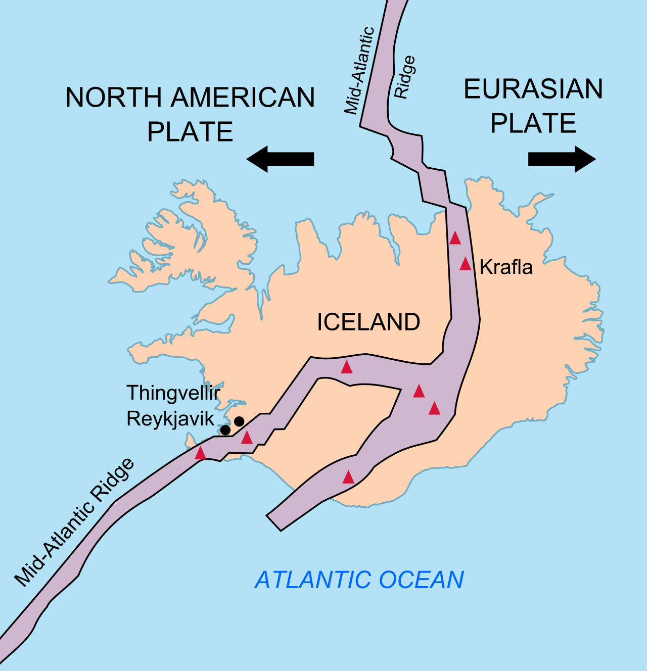
File:Iceland Mid-Atlantic Ridge map.svg
Jump to navigation
Jump to search

Size of this PNG preview of this SVG file: 376 × 390 pixels. Other resolutions: 231 × 240 pixels | 463 × 480 pixels | 740 × 768 pixels | 987 × 1,024 pixels | 1,974 × 2,048 pixels.
Original file (SVG file, nominally 376 × 390 pixels, file size: 129 KB)
Summary
| Description | |
| Date | |
| Source | http://pubs.usgs.gov/gip/dynamic/understanding.html |
| Author | http://pubs.usgs.gov/gip/dynamic/understanding.html |
| Other versions |
|


Licensing
This image is in the public domain in the United States because it only contains materials that originally came from the United States Geological Survey, an agency of the United States Department of the Interior. For more information, see the official USGS copyright policy.
|
| Annotations | This image is annotated: View the annotations at Commons |
File history
Click on a date/time to view the file as it appeared at that time.
| Date/Time | Thumbnail | Dimensions | User | Comment | |
|---|---|---|---|---|---|
| current | 18:48, 10 January 2014 | | 376 × 390 (129 KB) | wikimediacommons>Amitchell125 | text improved |
File usage
The following 2 pages use this file: