File:Ivory Coast Topography.png
Jump to navigation
Jump to search
Size of this preview: 565 × 600 pixels. Other resolutions: 226 × 240 pixels | 452 × 480 pixels | 1,009 × 1,071 pixels.
Original file (1,009 × 1,071 pixels, file size: 1.55 MB, MIME type: image/png)
Summary
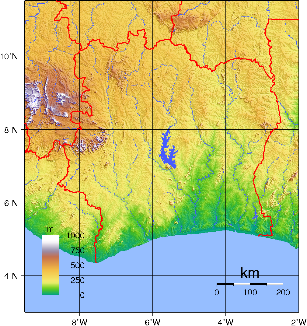
| Description | Topographic map of Ivory Coast. Created with GMT fro SRTM data. |
| Date | |
| Source | Own work |
| Author | Sadalmelik |
Licensing
| This work has been released into the public domain by its author, Sadalmelik. This applies worldwide. In some countries this may not be legally possible; if so: Sadalmelik grants anyone the right to use this work for any purpose, without any conditions, unless such conditions are required by law. |
File history
Click on a date/time to view the file as it appeared at that time.
| Date/Time | Thumbnail | Dimensions | User | Comment | |
|---|---|---|---|---|---|
| current | 20:11, 29 June 2007 | | 1,009 × 1,071 (1.55 MB) | wikimediacommons>Sadalmelik | {{Information |Description=Topographic map of Ivory Coast. Created with GMT fro SRTM data. |Source=self-made |Date=June 2, 2007 |Author= Sadalmelik }} Category:Maps of Côte d'Ivoire Category:Topographic maps of Africa |
File usage
The following page uses this file: