File:Iwate KamiHei-gun.png
Iwate_KamiHei-gun.png (256 × 306 pixels, file size: 7 KB, MIME type: image/png)
Summary
| Description |
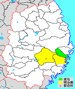
English: Map of Kamihei District, Iwate, Japan
日本語: 岩手県上閉伊郡、県内位置図 |
||
| Source | File:Japan map.png | ||
| Author |
|
||
| Permission (Reusing this file) |
|
Licensing

|
Permission is granted to copy, distribute and/or modify this document under the terms of the GNU Free Documentation License, Version 1.2 or any later version published by the Free Software Foundation; with no Invariant Sections, no Front-Cover Texts, and no Back-Cover Texts. A copy of the license is included in the section entitled GNU Free Documentation License. |
- You are free:
- to share – to copy, distribute and transmit the work
- to remix – to adapt the work
- Under the following conditions:
- attribution – You must give appropriate credit, provide a link to the license, and indicate if changes were made. You may do so in any reasonable manner, but not in any way that suggests the licensor endorses you or your use.
- share alike – If you remix, transform, or build upon the material, you must distribute your contributions under the same or compatible license as the original.
Original upload log
The original description page is/was here. All following user names refer to ja.wikipedia.
- 2014-02-08 10:45 検見川町 256 × 306 (7 kilobytes) 岩手県上閉伊郡、県内位置図 {{Japan map}}
File history
Click on a date/time to view the file as it appeared at that time.
| Date/Time | Thumbnail | Dimensions | User | Comment | |
|---|---|---|---|---|---|
| current | 07:32, 17 April 2014 | | 256 × 306 (7 KB) | wikimediacommons>MChew | {{Information |Description= Map of Kamihei District, Iwate, Japan |Source={{transferred from|ja.wikipedia|}} |Date={{original upload date|2014-02-08}} |Author={{original uploader|検見川町|wikipedia|ja}} |Permission= |other_versions= }} == {{int:li... |
File usage
The following page uses this file: