File:JesuitChineseWorldMapEarly17thCentury.jpg
Jump to navigation
Jump to search
Size of this preview: 800 × 400 pixels. Other resolutions: 320 × 160 pixels | 640 × 320 pixels | 1,024 × 512 pixels | 1,280 × 640 pixels | 2,924 × 1,462 pixels.
Original file (2,924 × 1,462 pixels, file size: 1.36 MB, MIME type: image/jpeg)
Summary
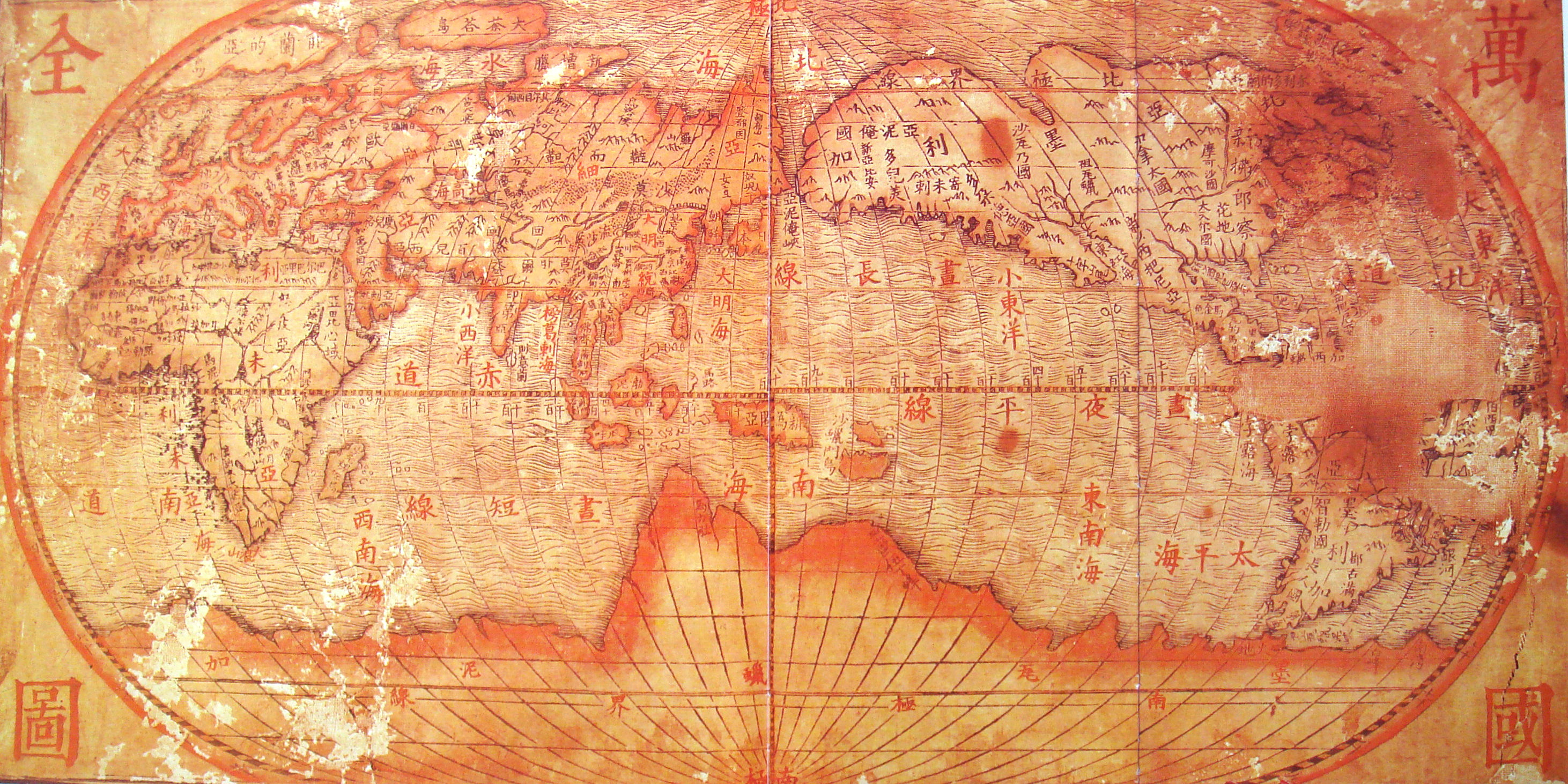
| Description | Chinese world map, drawn by the Jesuits (early 17th century). Reproduction in "Historic Maritime Maps" Donald Wigal |
| Date | Early 17th century (Ming period) |
| Source | 17th century Chinese map. |
| Author | Unknown author |
| Other versions |
|

Licensing
|
This is a faithful photographic reproduction of a two-dimensional, public domain work of art. The work of art itself is in the public domain for the following reason:
The official position taken by the Wikimedia Foundation is that "faithful reproductions of two-dimensional public domain works of art are public domain". This photographic reproduction is therefore also considered to be in the public domain in the United States. In other jurisdictions, re-use of this content may be restricted; see Reuse of PD-Art photographs for details. {{PD-Art}} template without license parameter: please specify why the underlying work is public domain in both the source country and the United States
(Usage: {{PD-Art|1=|deathyear=''year of author's death''|country=''source country''}}, where parameter 1= can be PD-old-auto, PD-old-auto-expired, PD-old-auto-1996, PD-old-100 or similar. See Commons:Multi-license copyright tags for more information.) | ||||
File history
Click on a date/time to view the file as it appeared at that time.
| Date/Time | Thumbnail | Dimensions | User | Comment | |
|---|---|---|---|---|---|
| current | 07:30, 24 April 2008 | | 2,924 × 1,462 (1.36 MB) | wikimediacommons>World Imaging | {{Information |Description=Chinese world map, drawn by the Jesuits (early 17th century). Reproduction in "Historic Maritime Maps" Donald Wigal |Source=17th century Chinese map. |Date=Early 17th century (Ming period) |Author=Unknown |Permission= |other_ver |
File usage
The following page uses this file: