File:Kingdom of Croatia.png
Jump to navigation
Jump to search
Size of this preview: 586 × 599 pixels. Other resolutions: 235 × 240 pixels | 470 × 480 pixels | 751 × 768 pixels | 1,218 × 1,245 pixels.
Original file (1,218 × 1,245 pixels, file size: 152 KB, MIME type: image/png)
Summary
| Description |
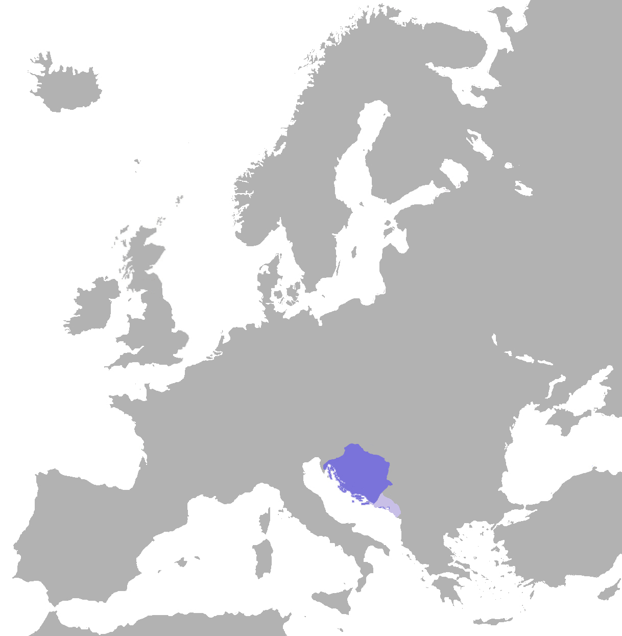
English: English: position of the croatian kingdom in europe (map) |
| Date | (UTC) |
| Source | |
| Author | Er-vet-en (talk) |
Licensing
| I, the copyright holder of this work, release this work into the public domain. This applies worldwide. In some countries this may not be legally possible; if so: I grant anyone the right to use this work for any purpose, without any conditions, unless such conditions are required by law. |
Original upload log
The original description page was here. All following user names refer to en.wikipedia.
| Upload date | User | Bytes | Dimensions | Comment |
|---|---|---|---|---|
| 2009-11-20 17:58:04 | Er-vet-en | 57804 | 1218×1245 | {{Information |Description = English: position of the croatian kingdom in europe (map) |Source = Made by (~~~); |Date = ~~~~~ |Author = ~~~ |other_versions = }} |
Licensing
This file is licensed under the Creative Commons Attribution-Share Alike 3.0 Unported license.
- You are free:
- to share – to copy, distribute and transmit the work
- to remix – to adapt the work
- Under the following conditions:
- attribution – You must give appropriate credit, provide a link to the license, and indicate if changes were made. You may do so in any reasonable manner, but not in any way that suggests the licensor endorses you or your use.
- share alike – If you remix, transform, or build upon the material, you must distribute your contributions under the same or compatible license as the original.
Original upload log
The original description page was here. All following user names refer to en.wikipedia.
- 2011-07-17 12:16 Er-vet-en 1218×1245× (161088 bytes)
- 2011-07-17 12:15 Er-vet-en 1218×1245× (161088 bytes)
- 2009-11-20 17:58 Er-vet-en 1218×1245× (57804 bytes) {{Information |Description = English: position of the croatian kingdom in europe (map) |Source = Made by (~~~); |Date = ~~~~~ |Author = ~~~ |other_versions = }}
File history
Click on a date/time to view the file as it appeared at that time.
| Date/Time | Thumbnail | Dimensions | User | Comment | |
|---|---|---|---|---|---|
| current | 12:49, 4 November 2019 | | 1,218 × 1,245 (152 KB) | wikimediacommons>Ceha | Corrected border in Istria, Dubrovnik and Kotor, and added vasal territoiries, Zahumlje, Travunja and Duklja |
File usage
The following page uses this file: