File:Kirkuk Demographical Map 2014.png
Jump to navigation
Jump to search

Size of this preview: 565 × 600 pixels. Other resolutions: 226 × 240 pixels | 452 × 480 pixels | 723 × 768 pixels | 964 × 1,024 pixels | 1,929 × 2,048 pixels | 8,390 × 8,908 pixels.
Original file (8,390 × 8,908 pixels, file size: 1.59 MB, MIME type: image/png)
Summary
.
| Description |
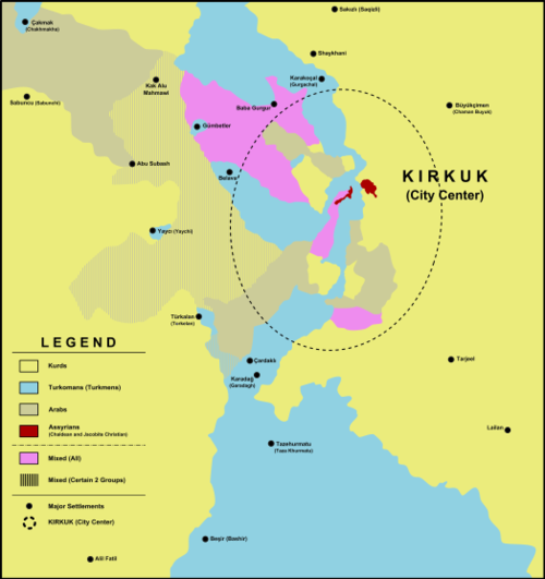
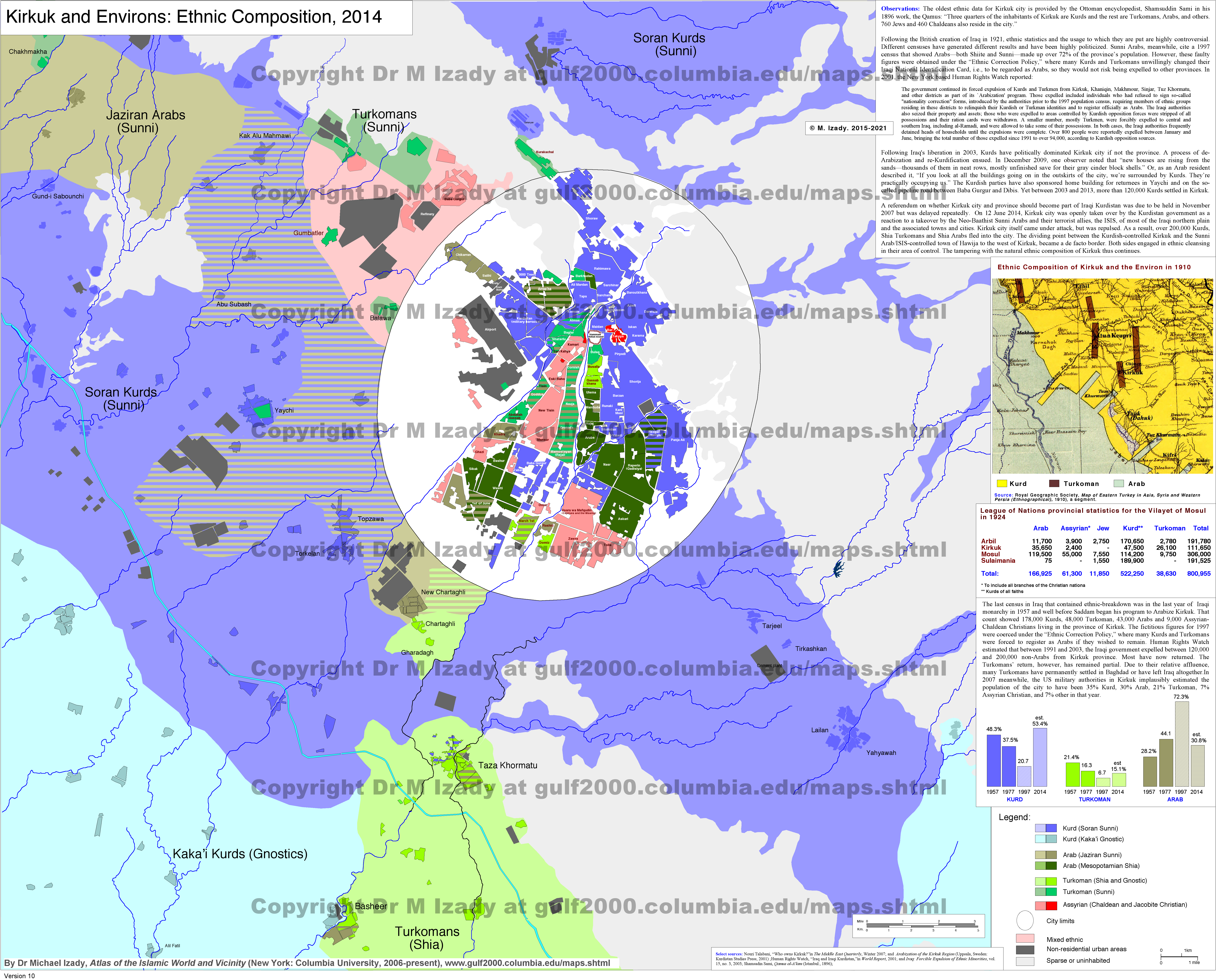
English: Demographical situation of the ethnic groups in Kirkuk and its environs in 2014 (At the time of the Kurdish capture of the city and mass Kurdish migration from north).
A combination of sources was used: Other
Türkçe: 2014 yılında, Kerkük ve çevresinde etnik grupların dağılımını gösteren demografik harita. (Şehrin Peşmerge kontrolüne geçişi ve kuzeyden yoğun Kürt nüfus göçünün yaşandığı dönem)
Birden fazla kaynaktan yararlanılmıştır: İkincil
|
||||||
| Date | |||||||
| Source | Own work | ||||||
| Author |
|
||||||
| Permission (Reusing this file) |
|
||||||
| Other versions |
|
||||||
| PNG development |


Licensing
I, the copyright holder of this work, hereby publish it under the following license:
This file is licensed under the Creative Commons Attribution-Share Alike 4.0 International license.
- You are free:
- to share – to copy, distribute and transmit the work
- to remix – to adapt the work
- Under the following conditions:
- attribution – You must give appropriate credit, provide a link to the license, and indicate if changes were made. You may do so in any reasonable manner, but not in any way that suggests the licensor endorses you or your use.
- share alike – If you remix, transform, or build upon the material, you must distribute your contributions under the same or compatible license as the original.
File history
Click on a date/time to view the file as it appeared at that time.
| Date/Time | Thumbnail | Dimensions | User | Comment | |
|---|---|---|---|---|---|
| current | 23:52, 17 October 2017 | | 8,390 × 8,908 (1.59 MB) | wikimediacommons>BRKY24 | User created page with UploadWizard |
File usage
The following page uses this file: