File:Kosovo02.png
Jump to navigation
Jump to search
Size of this preview: 546 × 599 pixels. Other resolutions: 219 × 240 pixels | 437 × 480 pixels | 770 × 845 pixels.
Original file (770 × 845 pixels, file size: 76 KB, MIME type: image/png)
Summary
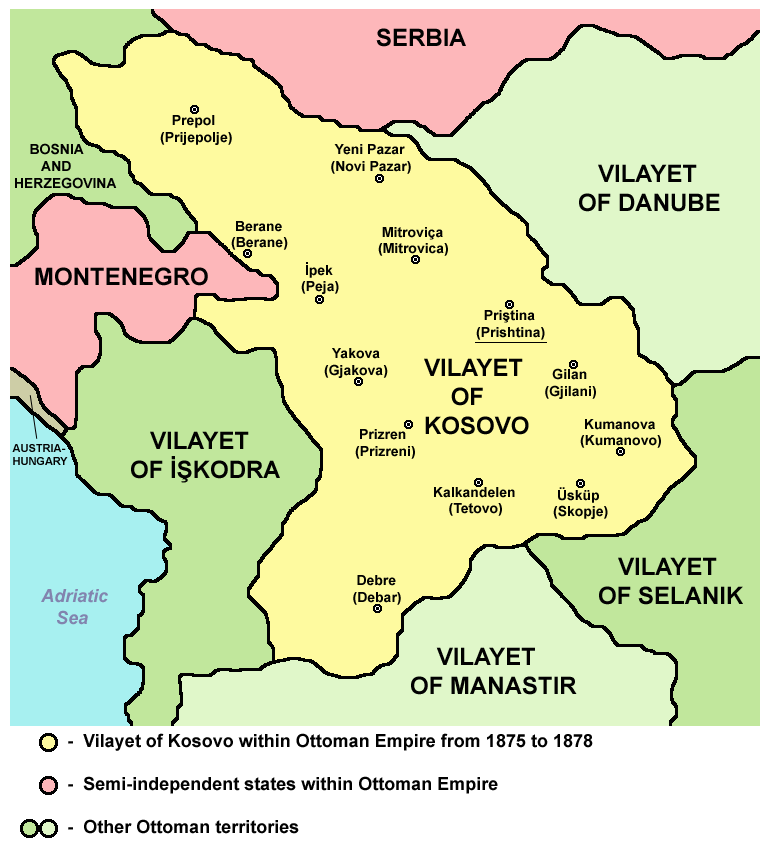
Vilayet of Kosovo within Ottoman Empire from 1875 to 1878.
Source and licence

|
This map has been uploaded by Electionworld from en.wikipedia.org to enable the |
| This work has been released into the public domain by its author, PANONIAN. This applies worldwide. In some countries this may not be legally possible; if so: |
References
Main reference:
- Created according to historical map from this book: Petrit Imami, Srbi i Albanci kroz vekove, Beograd, 2000.
Secondary references with similar maps:
- http://kosova.org/pics/maps/kosova_1878b.jpg
- http://img254.imageshack.us/img254/5316/shqiprian1878ye3.jpg
- http://www.tlfq.ulaval.ca/axl/europe/images/albanie-vilayets-map.gif
File history
Click on a date/time to view the file as it appeared at that time.
| Date/Time | Thumbnail | Dimensions | User | Comment | |
|---|---|---|---|---|---|
| current | 12:46, 11 September 2012 | | 770 × 845 (76 KB) | wikimediacommons>WikiEditor2004 | cosmetic changes |
File usage
The following page uses this file: