File:Kukenan Roraima GS.jpg
Original file (4,851 × 1,533 pixels, file size: 3.64 MB, MIME type: image/jpeg)
Summary
| Description |
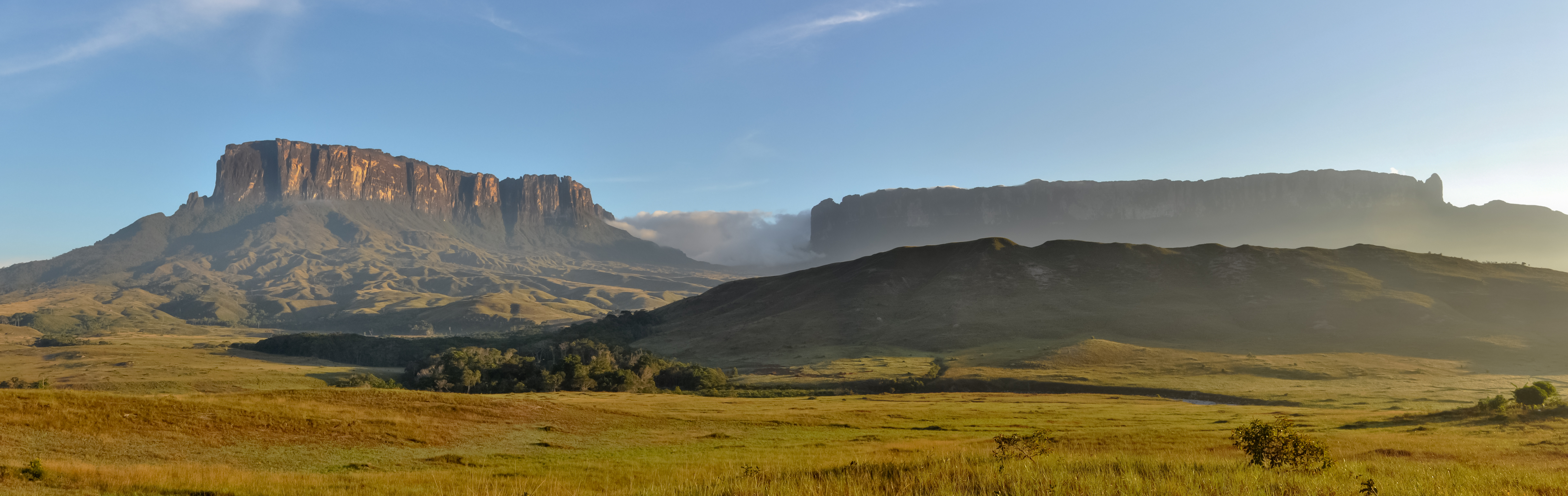
English: Morning view of Kukenan and Roraima tepuis, from Tëk river camp (river visible in the image), in Gran Sabana, Venezuela. Roraima tepui is actually some 100 mts higher than Kukenan, but due to the perspective of the picture, it looks like it is lower.
Español: Vista matutina de los tepuys Kukenan y Roraima, desde el campamente del río Tëk (con el río visible en la imagen), en la Gran Sabana, Venezuela. El tepuy Roraima es en realidad unos cien metros más alto que el Kukenan, aunque por la perspectiva de la foto, parece lo contrario.
Français : Vue matinale sur le Tepuy Kukenan et le Mont Roraima, depuis le camp de la rivière Tëk, dans la Gran Sabana (Vénézuela). Le Roraima Fait 100 m de plus que le Kukenan, bien qu'il apparaisse moins haut sur l'image, à cause de la perspective.
Bosanski: Jutarnja panorama Kukenana i tepui planine Roraima, iz riječnog kampa Tëk, Gran Sabana, Venecuela.
Italiano: Panorama al mattino dei tepui di Kukenan e Roraima dal campo sul fiume Tëk, Gran Sabana in Venezuela.
|
|||
| Date | ||||
| Source | Own work | |||
| Author | Paolo Costa Baldi | |||
| Permission (Reusing this file) |
|
| Camera location |  | View this and other nearby images on: OpenStreetMap |  |
|---|
|


|
This image was selected as picture of the day on Wikimedia Commons for 10 July 2015. It was captioned as follows: Other languages:
Bosanski: Jutarnja panorama Kukenana i tepui planine Roraima, iz riječnog kampa Tëk, Gran Sabana, Venecuela. Español: Vista matutina de los tepuys Kukenan y Roraima, desde el campamente del río Tëk (con el río visible en la imagen), en la Gran Sabana, Venezuela. Italiano: Panorama al mattino dei tepui di Kukenan e Roraima dal campo sul fiume Tëk, Gran Sabana in Venezuela. |
Licensing


- You are free:
- to share – to copy, distribute and transmit the work
- to remix – to adapt the work
- Under the following conditions:
- attribution – You must give appropriate credit, provide a link to the license, and indicate if changes were made. You may do so in any reasonable manner, but not in any way that suggests the licensor endorses you or your use.
- share alike – If you remix, transform, or build upon the material, you must distribute your contributions under the same or compatible license as the original.

|
Permission is granted to copy, distribute and/or modify this document under the terms of the GNU Free Documentation License, Version 1.2 or any later version published by the Free Software Foundation; with no Invariant Sections, no Front-Cover Texts, and no Back-Cover Texts. A copy of the license is included in the section entitled GNU Free Documentation License. |
| Annotations | This image is annotated: View the annotations at Commons |
File history
Click on a date/time to view the file as it appeared at that time.
| Date/Time | Thumbnail | Dimensions | User | Comment | |
|---|---|---|---|---|---|
| current | 03:42, 20 October 2011 | | 4,851 × 1,533 (3.64 MB) | wikimediacommons>Paolostefano1412 | {{Information |Description ={{en|1=Morning view of Kukenan and Roraima tepuis, from River Tëk camp (river visible in the image).}} {{es|1=Vista matutina de los tepuys Kukenan y Roraima, desde el campamente del río Tëk (con el río visible en la imag |
File usage
The following page uses this file:
