File:Los Angeles Aqueduct Map.png
Jump to navigation
Jump to search
Size of this preview: 428 × 599 pixels. Other resolutions: 171 × 240 pixels | 343 × 480 pixels | 548 × 768 pixels | 731 × 1,024 pixels | 1,357 × 1,900 pixels.
Original file (1,357 × 1,900 pixels, file size: 4.62 MB, MIME type: image/png)
| Description |
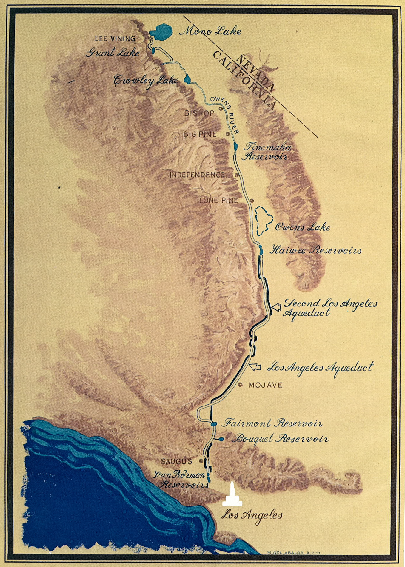
English: Map of the Los Angeles Aqueduct — its route and facilities, in eastern and southern California. |
|||
| Date | ||||
| Source | Report from the City of Los Angeles | |||
| Author | The City of Los Angeles | |||
| Permission (Reusing this file) |
|

File history
Click on a date/time to view the file as it appeared at that time.
| Date/Time | Thumbnail | Dimensions | User | Comment | |
|---|---|---|---|---|---|
| current | 05:21, 29 September 2013 | | 1,357 × 1,900 (4.62 MB) | wikimediacommons>Dcoffida | {{Information |Description ={{en|1=Map of the Los Angeles Aqueduct}} |Source =Report from the City of Los Angeles |Author =The City of Los Angeles |Date =1971 |Permission ={{PD-US-no notice |1= }} |other_versions = }} |
File usage
The following page uses this file: