File:Lunar south pole.jpg
Jump to navigation
Jump to search
Size of this preview: 562 × 599 pixels. Other resolutions: 225 × 240 pixels | 450 × 480 pixels | 720 × 768 pixels | 960 × 1,024 pixels | 1,920 × 2,048 pixels | 2,999 × 3,199 pixels.
Original file (2,999 × 3,199 pixels, file size: 932 KB, MIME type: image/jpeg)
Summary
| Description |
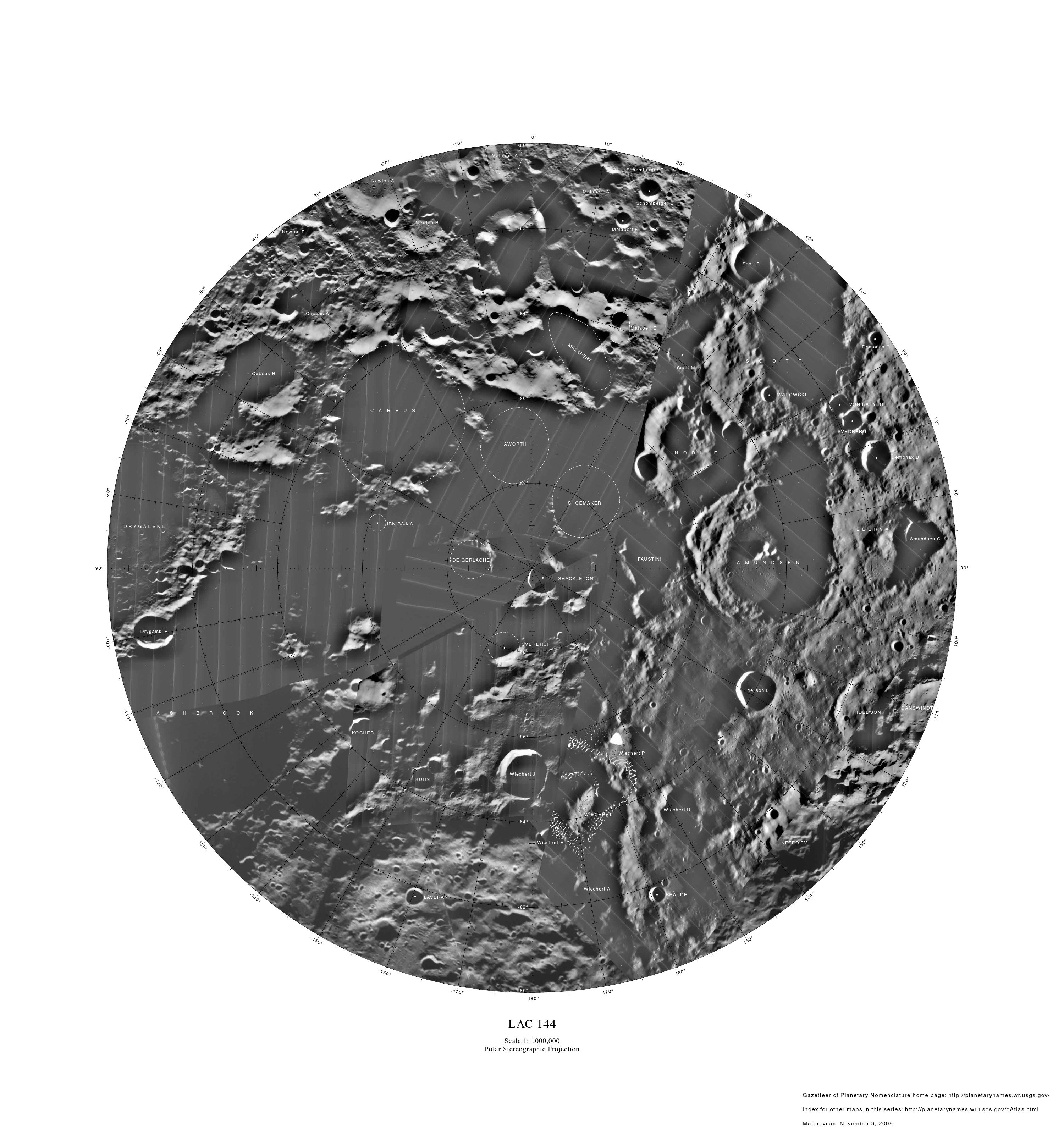
English: Lunar map depicting craters on the south pole of the moon. LAC 144. Polar Stereographic Projection. Map revised November 9, 2009. Index for other maps in this series: http://planetarynames.wr.usgs.gov/dAtlas.html. |
| Date | |
| Source | http://planetarynames.wr.usgs.gov/images/Lunar/lac_144_lo.pdf |
| Author | USGS |
| Other versions | File:Lunar-south-pole--with-malapert-a-crater.jpg |
Licensing
This image is in the public domain in the United States because it only contains materials that originally came from the United States Geological Survey, an agency of the United States Department of the Interior. For more information, see the official USGS copyright policy.
|
File history
Click on a date/time to view the file as it appeared at that time.
| Date/Time | Thumbnail | Dimensions | User | Comment | |
|---|---|---|---|---|---|
| current | 03:46, 10 January 2011 | | 2,999 × 3,199 (932 KB) | wikimediacommons>LobStoR | increased quality, reduced palette from 24-bit RGB to 8-bit greyscale |
File usage
The following page uses this file: