File:Manson crater landsat map.jpg
Jump to navigation
Jump to search
Size of this preview: 600 × 600 pixels. Other resolutions: 240 × 240 pixels | 480 × 480 pixels | 768 × 768 pixels | 1,024 × 1,024 pixels | 1,700 × 1,700 pixels.
Original file (1,700 × 1,700 pixels, file size: 808 KB, MIME type: image/jpeg)
Summary
| Description |
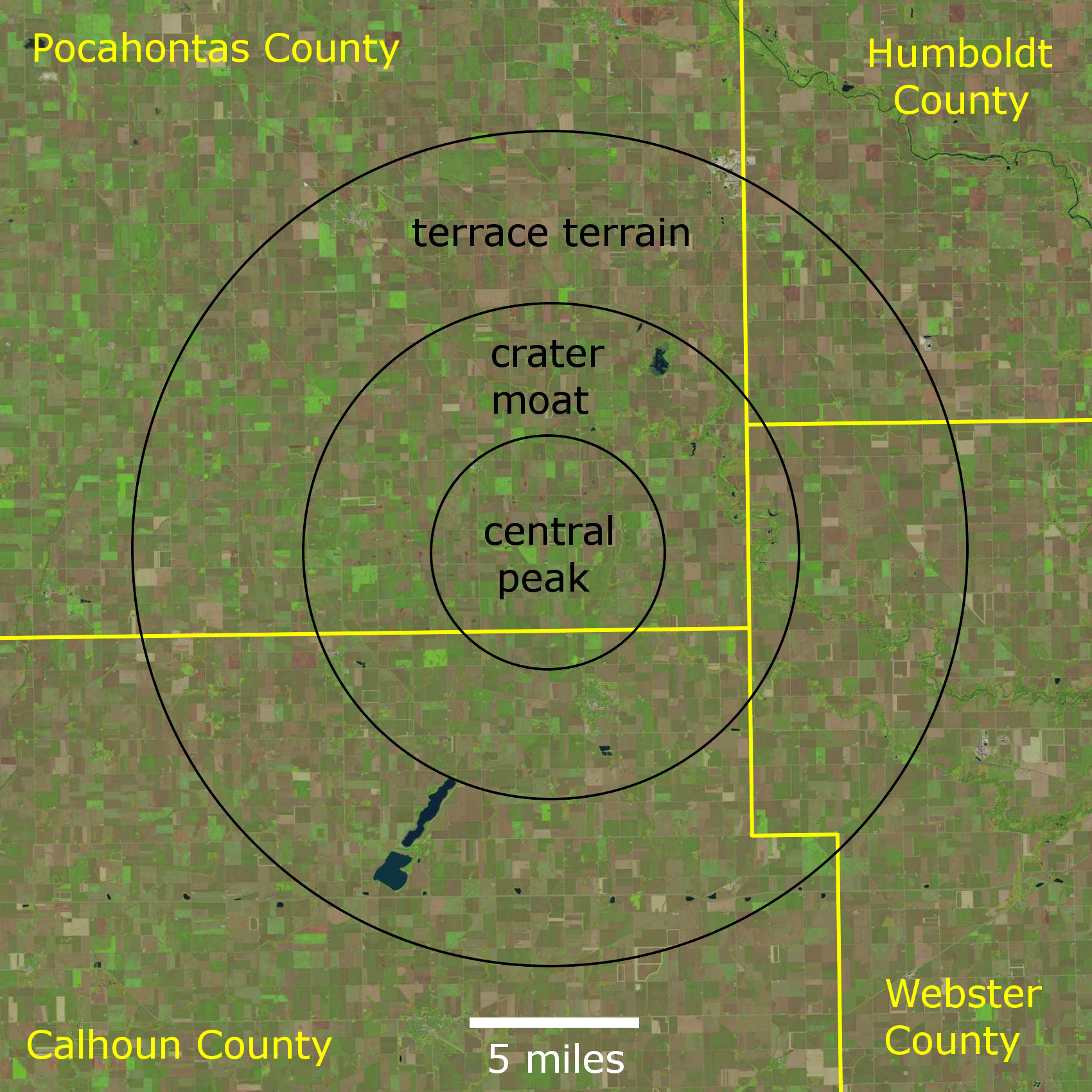
English: Map of the Manson impact structure in northwestern Iowa, United States. Based on Figure 1 of Geology, geophysics, and geochronology of the Manson impact structure. by Hartung, J. B., Kunk, M.J. and Anderson, R.R., in Global Catastrophes in Earth History, Geological Society of America, Special Paper 247, pp. 207-221. 1990.
Landsat images dated 04 October 2021, downloaded from EarthExplorer:
|
| Date | |
| Source | Own work |
| Author | Jstuby |
Licensing
I, the copyright holder of this work, hereby publish it under the following license:
| This file is made available under the Creative Commons CC0 1.0 Universal Public Domain Dedication. | |
| The person who associated a work with this deed has dedicated the work to the public domain by waiving all of their rights to the work worldwide under copyright law, including all related and neighboring rights, to the extent allowed by law. You can copy, modify, distribute and perform the work, even for commercial purposes, all without asking permission.
|
File history
Click on a date/time to view the file as it appeared at that time.
| Date/Time | Thumbnail | Dimensions | User | Comment | |
|---|---|---|---|---|---|
| current | 21:56, 15 November 2021 | | 1,700 × 1,700 (808 KB) | wikimediacommons>Jstuby | replace ring graben with terrace terrane |
File usage
The following page uses this file: