File:Map-NDB.svg
Jump to navigation
Jump to search

Size of this PNG preview of this SVG file: 707 × 600 pixels. Other resolutions: 283 × 240 pixels | 566 × 480 pixels | 905 × 768 pixels | 1,207 × 1,024 pixels | 2,414 × 2,048 pixels | 2,621 × 2,224 pixels.
Original file (SVG file, nominally 2,621 × 2,224 pixels, file size: 713 KB)
Summary
| Description |
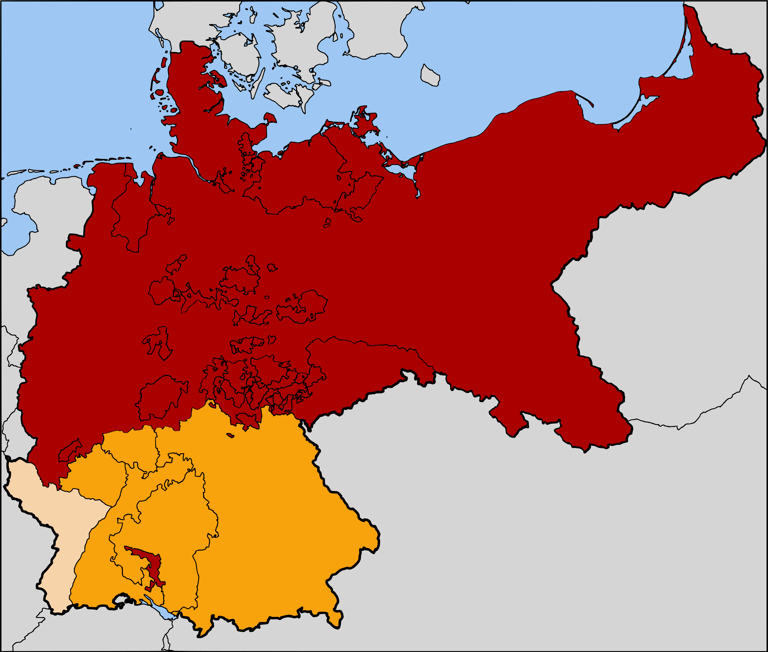
English: The North German Confederation / Norddeutscher Bund (1867–1871) in red. The states that would join the confederation and form the German Empire are in orange. Alsace-Lorraine, the territory annexed from France following the Franco-Prussian War of 1871, is in a paler orange. |
| Date | |
| Source | Based on map data of the IEG-Maps project (Andreas Kunz, B. Johnen and Joachim Robert Moeschl: University of Mainz) - http://www.ieg-maps.uni-mainz.de |
| Author | User:52 Pickup |
Licensing
This file is licensed under the Creative Commons Attribution-Share Alike 2.5 Generic license.
- You are free:
- to share – to copy, distribute and transmit the work
- to remix – to adapt the work
- Under the following conditions:
- attribution – You must give appropriate credit, provide a link to the license, and indicate if changes were made. You may do so in any reasonable manner, but not in any way that suggests the licensor endorses you or your use.
- share alike – If you remix, transform, or build upon the material, you must distribute your contributions under the same or compatible license as the original.
File history
Click on a date/time to view the file as it appeared at that time.
| Date/Time | Thumbnail | Dimensions | User | Comment | |
|---|---|---|---|---|---|
| current | 06:11, 25 July 2007 | | 2,621 × 2,224 (713 KB) | wikimediacommons>52 Pickup | now with Alsace-Lorraine coloured in |
File usage
The following 2 pages use this file: