File:Map-alexander-empire.png
Jump to navigation
Jump to search
Size of this preview: 800 × 521 pixels. Other resolutions: 320 × 208 pixels | 640 × 417 pixels | 929 × 605 pixels.
Original file (929 × 605 pixels, file size: 87 KB, MIME type: image/png)
Summary
| Description |
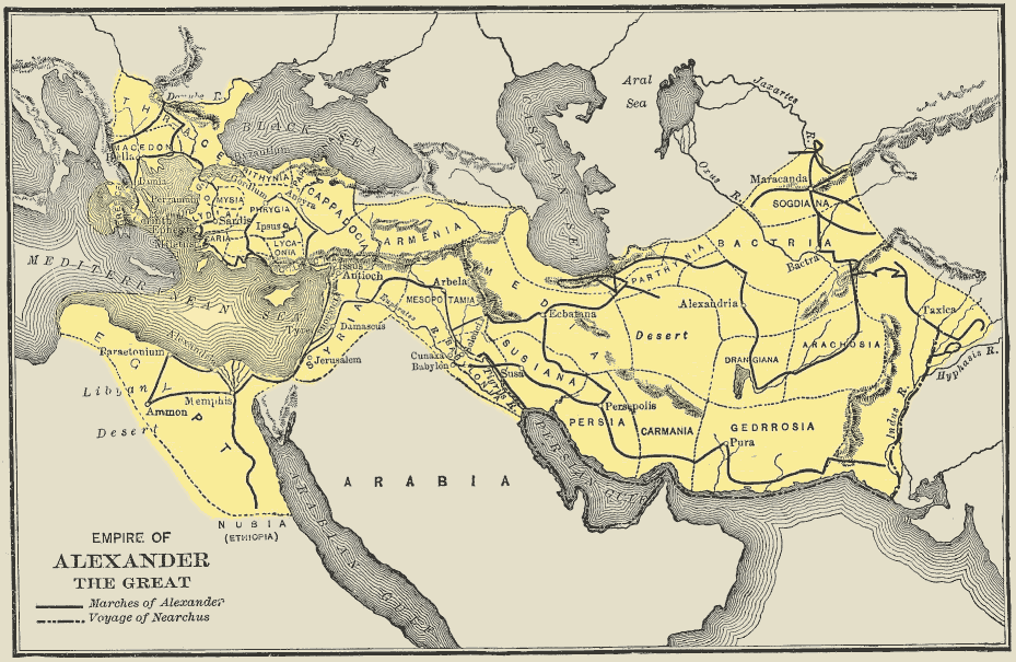
English: Map of empire of Alexander the Great shortly after acquiring the Persian Empire. |
| Date | |
| Source | From A History of the Ancient World by George Willis Botsford Ph.D., published by The MacMillan Company in 1913. |
| Author | George Willis Botsford Ph.D. (1862-1917) |
| Other versions |
|

Licensing
|
The author died in 1917, so this work is in the public domain in its country of origin and other countries and areas where the copyright term is the author's life plus 100 years or fewer. This work is in the public domain in the United States because it was published (or registered with the U.S. Copyright Office) before January 1, 1931. | |
| This file has been identified as being free of known restrictions under copyright law, including all related and neighboring rights. | |
File history
Click on a date/time to view the file as it appeared at that time.
| Date/Time | Thumbnail | Dimensions | User | Comment | |
|---|---|---|---|---|---|
| current | 07:46, 11 August 2015 | | 929 × 605 (87 KB) | wikimediacommons>AnonMoos | Reverted to version as of 07:33, 10 November 2005 -- this is a map from a specific 1913 source; please don't personally reinterpret it (if you do, upload as separate file under new name please) |
File usage
The following 2 pages use this file: