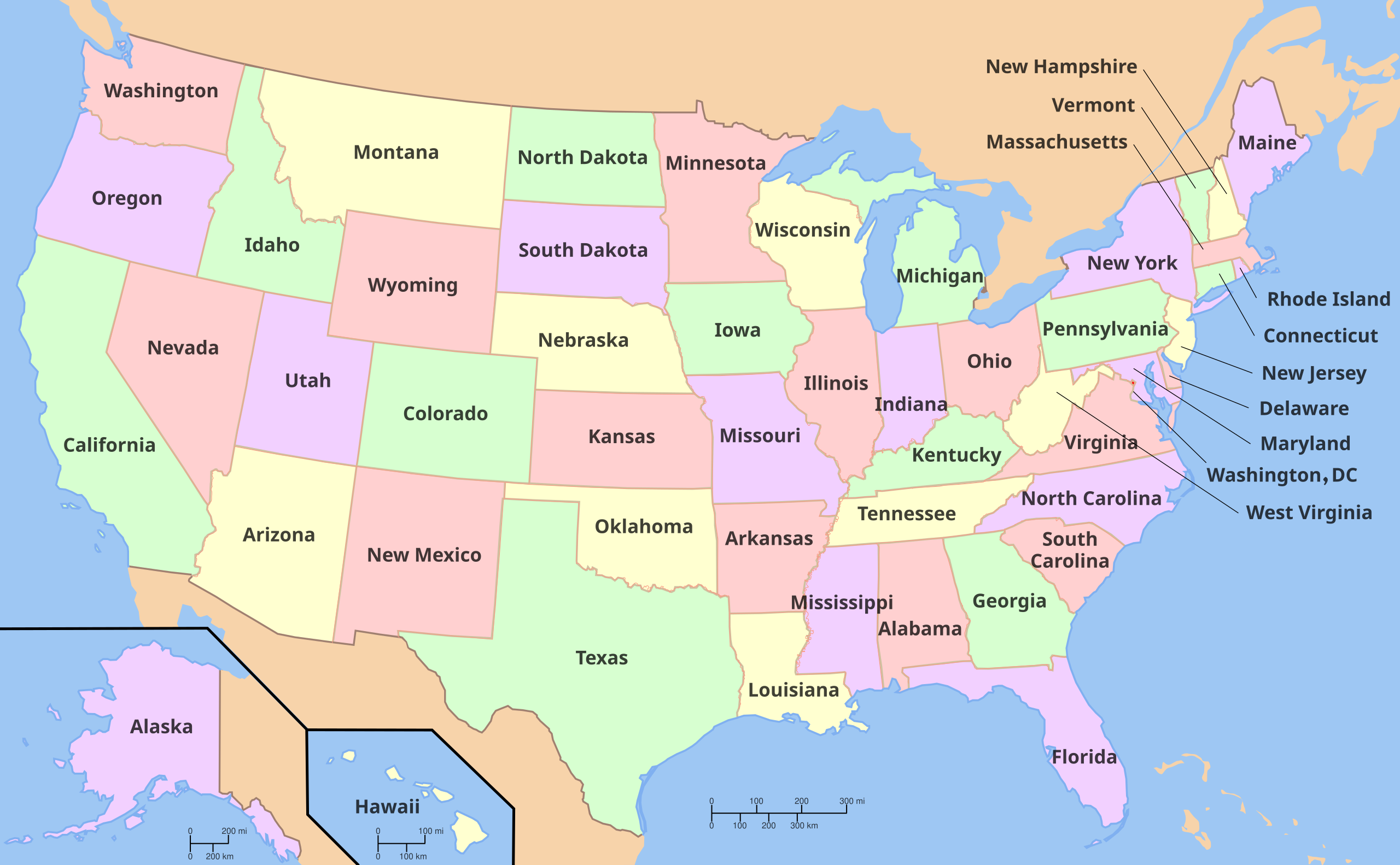
File:Map of USA with state names.svg
Jump to navigation
Jump to search

Size of this PNG preview of this SVG file: 800 × 495 pixels. Other resolutions: 320 × 198 pixels | 640 × 396 pixels | 1,024 × 633 pixels | 1,280 × 791 pixels | 2,560 × 1,583 pixels | 959 × 593 pixels.
Original file (SVG file, nominally 959 × 593 pixels, file size: 990 KB)
Summary


.svg)


Versions
Non-modifiable text

Clickable

Licensing

|
Permission is granted to copy, distribute and/or modify this document under the terms of the GNU Free Documentation License, Version 1.2 or any later version published by the Free Software Foundation; with no Invariant Sections, no Front-Cover Texts, and no Back-Cover Texts. A copy of the license is included in the section entitled GNU Free Documentation License. |
| This file is licensed under the Creative Commons Attribution-Share Alike 3.0 Unported license. | ||
| ||
| This licensing tag was added to this file as part of the GFDL licensing update. |
Original upload
The original was edited by Andrew c to include Nova Scotia, PEI, Bahamas, and scale key. It was originally uploaded to the English Wikipedia with the same title by Wapcaplet:
- 20:57, 9 October 2005 . . Dbenbenn . . 959x593 (339217 bytes) (fix South Carolina label)
- 20:27, 9 October 2005 . . Dbenbenn . . 959x593 (339227 bytes) (typo, Massachussetts -> Massachusetts)
- 19:01, 9 October 2005 . . Dbenbenn . . 959x593 (371653 bytes) (crop, and remove some shapes (rivers, highways, capitals, lakes) that didn't display anyway)
- 13:18, 23 September 2005 . . Ed g2s . . 990x855 (978668 bytes) (fix (removed <image /> tag))
- 23:48, 23 September 2004 . . Wapcaplet . . 0x0 (978926 bytes) (SVG map of the United States. Created by Wapcaplet. {{GFDL} })
File history
Click on a date/time to view the file as it appeared at that time.
| Date/Time | Thumbnail | Dimensions | User | Comment | |
|---|---|---|---|---|---|
| current | 17:54, 16 February 2025 | | 959 × 593 (990 KB) | wikimediacommons>Narazeni | File uploaded using svgtranslate tool (https://svgtranslate.toolforge.org/). Added translation for xmf. |
File usage
The following page uses this file: