File:Monocacy.png
Jump to navigation
Jump to search
Size of this preview: 511 × 599 pixels. Other resolutions: 205 × 240 pixels | 409 × 480 pixels | 1,000 × 1,172 pixels.
Original file (1,000 × 1,172 pixels, file size: 544 KB, MIME type: image/png)
Summary
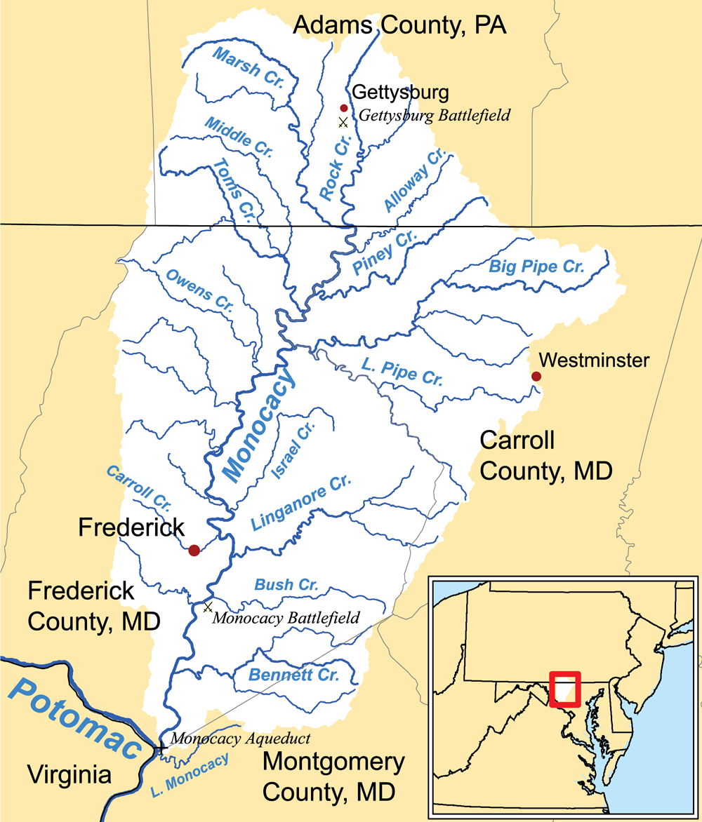
| Description | This is a map of the Monocacy River Watershed I made using USGS and Census Bureau data. |
| Date | 18 May 2006 (original upload date) |
| Source | No machine-readable source provided. Own work assumed (based on copyright claims). |
| Author | No machine-readable author provided. Kmusser assumed (based on copyright claims). |
Licensing
I, the copyright holder of this work, hereby publish it under the following license:
This file is licensed under the Creative Commons Attribution-Share Alike 2.5 Generic license.
- You are free:
- to share – to copy, distribute and transmit the work
- to remix – to adapt the work
- Under the following conditions:
- attribution – You must give appropriate credit, provide a link to the license, and indicate if changes were made. You may do so in any reasonable manner, but not in any way that suggests the licensor endorses you or your use.
- share alike – If you remix, transform, or build upon the material, you must distribute your contributions under the same or compatible license as the original.
File history
Click on a date/time to view the file as it appeared at that time.
| Date/Time | Thumbnail | Dimensions | User | Comment | |
|---|---|---|---|---|---|
| current | 01:49, 28 March 2011 | | 1,000 × 1,172 (544 KB) | wikimediacommons>Kmusser | higher resolution, more detailed map |
File usage
The following page uses this file: