File:Murray Islands (Landsat).png
Jump to navigation
Jump to search
No higher resolution available.
Murray_Islands_(Landsat).png (512 × 256 pixels, file size: 249 KB, MIME type: image/png)
.png)
Summary
| Description |
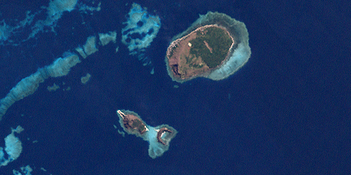
English: Murray Islands, Torres Strait Islands, Queensland, Australia. Islands: Murray Island (north), Dowar Islet (southwest), Wyer Islet (south) |
| Date | |
| Source | http://oceancolor.gsfc.nasa.gov/cgi/landsat_extract.pl?path=98&row=67&x=2609&y=-703&n=0&t=321 |
| Author | NASA |
Licensing
| This file is in the public domain in the United States because it was solely created by NASA. NASA copyright policy states that "NASA material is not protected by copyright unless noted". (See Template:PD-USGov, NASA copyright policy page or JPL Image Use Policy.) | ||
 |
Warnings:
|
File history
Click on a date/time to view the file as it appeared at that time.
| Date/Time | Thumbnail | Dimensions | User | Comment | |
|---|---|---|---|---|---|
| current | 19:09, 29 October 2011 | | 512 × 256 (249 KB) | wikimediacommons>Wurfzoll |
File usage
The following page uses this file:
.png)