File:NGA-Pacific Loran.png
Jump to navigation
Jump to search

Size of this preview: 800 × 589 pixels. Other resolutions: 320 × 235 pixels | 640 × 471 pixels | 1,024 × 753 pixels | 1,280 × 942 pixels | 2,044 × 1,504 pixels.
Original file (2,044 × 1,504 pixels, file size: 333 KB, MIME type: image/png)
Summary
| Description |
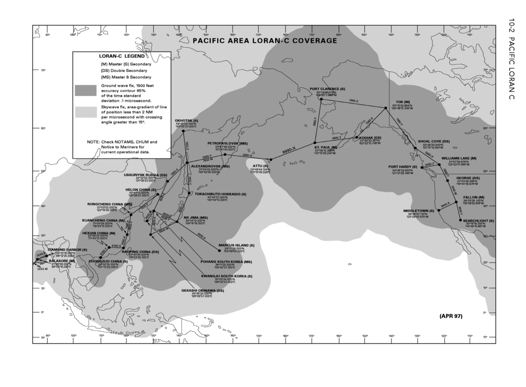
English: Coverage of Pacific Ocean LORAN-C chains as in 2006. |
| Date | (first publication of chart April 1997) |
| Source | From DoD General Planning, 6 July 2006, NGA ref PLANXGP, page 10-2. |
| Author | unlisted - collective work |
| Other versions |
This picture is part of a set: LORAN-C World coverage (2006)
|
| OpenStreetMap | Node 2953240203 |


| Object location | | View this and other nearby images on: OpenStreetMap |
|---|
Licensing
This image is a work of the United States National Geospatial-Intelligence Agency or one of its predecessor agencies. As a work of the U.S. federal government, the image is in the public domain.
|
 |
This file was reviewed on 28 May 2009 by the administrator or trusted user Jappalang (talk), who confirmed the Public Domain status on that date.
See talk page for why this image's PD status was endorsed by PD reviewers. |
File history
Click on a date/time to view the file as it appeared at that time.
| Date/Time | Thumbnail | Dimensions | User | Comment | |
|---|---|---|---|---|---|
| current | 04:51, 4 May 2009 | | 2,044 × 1,504 (333 KB) | wikimediacommons>Sv1xv | Landscape mode |
File usage
The following page uses this file: