File:Northern Sea Route vs Southern Sea Route.svg
Jump to navigation
Jump to search

Size of this PNG preview of this SVG file: 550 × 550 pixels. Other resolutions: 240 × 240 pixels | 480 × 480 pixels | 768 × 768 pixels | 1,024 × 1,024 pixels | 2,048 × 2,048 pixels.
Original file (SVG file, nominally 550 × 550 pixels, file size: 227 KB)
Summary
| Description |
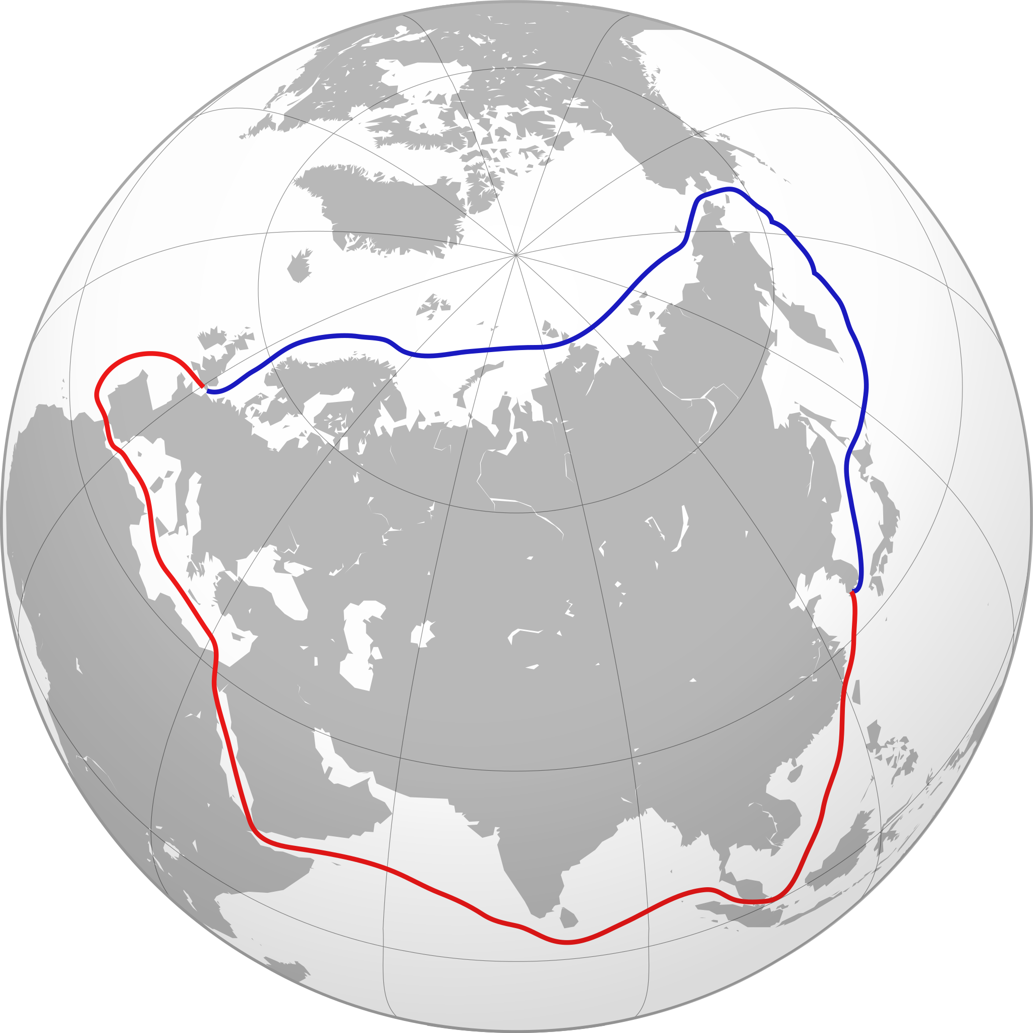
English: A graphical comparison between the Northern Sea Route (blue) and a southern route (red). |
| Date | (UTC) |
| Source | |
| Author |
|
.svg)
| This is a retouched picture, which means that it has been digitally altered from its original version. Modifications: added sea routes. The original can be viewed here: Kazakhstan (orthographic projection).svg:
|
Collin Knopp-Schwyn and Turkish Flame, the copyright holder of this work, hereby publishes it under the following licenses:
This file is licensed under the Creative Commons Attribution 4.0 International license.
Attribution:
Collin Knopp-Schwyn and Turkish Flame
- You are free:
- to share – to copy, distribute and transmit the work
- to remix – to adapt the work
- Under the following conditions:
- attribution – You must give appropriate credit, provide a link to the license, and indicate if changes were made. You may do so in any reasonable manner, but not in any way that suggests the licensor endorses you or your use.
The map has been created with the Generic Mapping Tools: https://www.generic-mapping-tools.org/ using one or more of these public-domain datasets for the relief:
|

|
Permission is granted to copy, distribute and/or modify this document under the terms of the GNU Free Documentation License, Version 1.2 or any later version published by the Free Software Foundation; with no Invariant Sections, no Front-Cover Texts, and no Back-Cover Texts. A copy of the license is included in the section entitled GNU Free Documentation License. |
You may select the license of your choice.
Original upload log
This image is a derivative work of the following images:
- File:Kazakhstan_(orthographic_projection).svg licensed with Cc-by-3.0, GFDL-GMT
- 2008-11-01T17:10:46Z Turkish Flame 541x541 (576009 Bytes) == Summary == {{Information |Description={{en|1=Kazakhstan}} |Source=Own work, {{Inkscape}}[http://www.aquarius.geomar.de/omc/make_map.html Aquarius.geomar.de]{{GFDL-GMT}} |Author=[[User:Turkish Flame|Turkish Flame]] |Date=1
Uploaded with derivativeFX
Licensing
This file is licensed under the Creative Commons Attribution-Share Alike 4.0 International license.
Attribution:
Collin Knopp-Schwyn and Turkish Flame
- You are free:
- to share – to copy, distribute and transmit the work
- to remix – to adapt the work
- Under the following conditions:
- attribution – You must give appropriate credit, provide a link to the license, and indicate if changes were made. You may do so in any reasonable manner, but not in any way that suggests the licensor endorses you or your use.
- share alike – If you remix, transform, or build upon the material, you must distribute your contributions under the same or compatible license as the original.
| Annotations | This image is annotated: View the annotations at Commons |
File history
Click on a date/time to view the file as it appeared at that time.
| Date/Time | Thumbnail | Dimensions | User | Comment | |
|---|---|---|---|---|---|
| current | 21:34, 7 October 2009 | | 550 × 550 (227 KB) | wikimediacommons>Keepscases | helping |
File usage
The following 2 pages use this file: