File:Operation Market I - 04.jpg
Jump to navigation
Jump to search
Size of this preview: 438 × 600 pixels. Other resolutions: 175 × 240 pixels | 350 × 480 pixels | 949 × 1,300 pixels.
Original file (949 × 1,300 pixels, file size: 362 KB, MIME type: image/jpeg)
| Description |
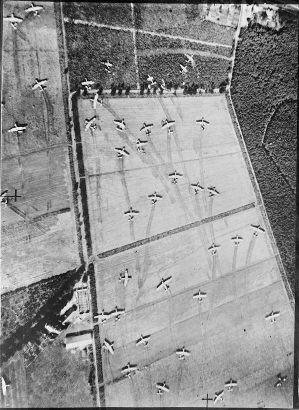
English: Operation MARKET I: the airborne operation to seize bridges between Arnhem and Eindhoven, Holland, (part of Operation Market Garden). Vertical photographic-reconnaissance aerial showing Airspeed Horsa and General Aircraft Hamilcar on Landing Zone (LZ) 'Z' near Wolfheze woods, west-north-west of Arnhem. 17 September 1944
Nederlands: Operatie MARKET I: the luchtlandingsoperatie om de bruggen tussen Arnhem en Eindhoven veilig te stellen (Gedeelte van Operation Market Garden). General Aircraft Hamilcar zweefvliegtuigen op een landingsstrip in de buurt van Wolfheze, WNW van Arnhem op 17 september 1944 |
|||
| Date | ||||
| Source |
|
|||
| Author |
No. 16 Squadron RAF Detachment |
|||
| Permission (Reusing this file) |
Unrestricted per IWM
|


| Camera location | | View this and other nearby images on: OpenStreetMap |
|---|
File history
Click on a date/time to view the file as it appeared at that time.
| Date/Time | Thumbnail | Dimensions | User | Comment | |
|---|---|---|---|---|---|
| current | 14:59, 12 February 2025 | | 949 × 1,300 (362 KB) | wikimediacommons>Ich | larger |
File usage
The following page uses this file: