File:Pacific Ring of Fire.svg
Jump to navigation
Jump to search

Size of this PNG preview of this SVG file: 800 × 483 pixels. Other resolutions: 320 × 193 pixels | 640 × 387 pixels | 1,024 × 619 pixels | 1,280 × 773 pixels | 2,560 × 1,546 pixels | 942 × 569 pixels.
Original file (SVG file, nominally 942 × 569 pixels, file size: 299 KB)
Summary
| Description |
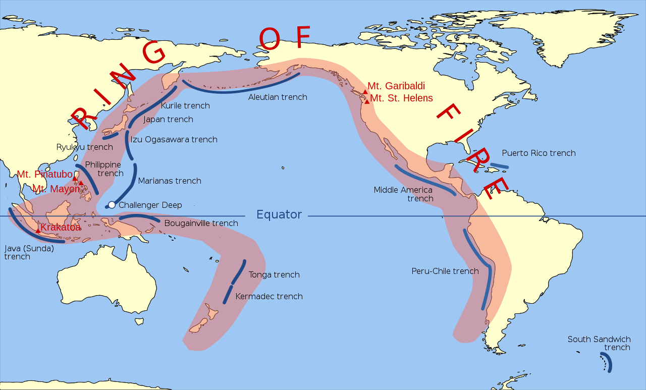
English: Volcanic arcs and oceanic trenches partly encircling the Pacific Basin form the so-called Pacific Ring of fire, a zone of frequent earthquakes and volcanic eruptions. The trenches are shown in blue-green. The volcanic island arcs, although not labelled, are parallel to, and always landward of, the trenches. For example, the island arc associated with the Aleutian Trench is represented by the long chain of volcanoes that make up the Aleutian Islands. (SVG version of File:Pacific_Ring_of_Fire.png, recreated by Gringer using WDB vector data using code mentioned in File:Worldmap_wdb_combined.svg.) |
| Date | |
| Source | vector data from [1] |
| Author | Gringer (talk) 23:52, 10 February 2009 (UTC) |
| Other versions |
Derivative works of this file: []
|


Licensing
| I, the copyright holder of this work, release this work into the public domain. This applies worldwide. In some countries this may not be legally possible; if so: I grant anyone the right to use this work for any purpose, without any conditions, unless such conditions are required by law. |
File history
Click on a date/time to view the file as it appeared at that time.
| Date/Time | Thumbnail | Dimensions | User | Comment | |
|---|---|---|---|---|---|
| current | 16:33, 30 November 2024 | | 942 × 569 (299 KB) | wikimediacommons>FrozenCourgette | File uploaded using svgtranslate tool (https://svgtranslate.toolforge.org/). Added translation for fr. |
File usage
The following 2 pages use this file: