File:Sacramento and Feather River diazinon improvements.jpg
Jump to navigation
Jump to search

Size of this preview: 463 × 599 pixels. Other resolutions: 185 × 240 pixels | 371 × 480 pixels | 960 × 1,242 pixels.
Original file (960 × 1,242 pixels, file size: 269 KB, MIME type: image/jpeg)
Summary
| Description |
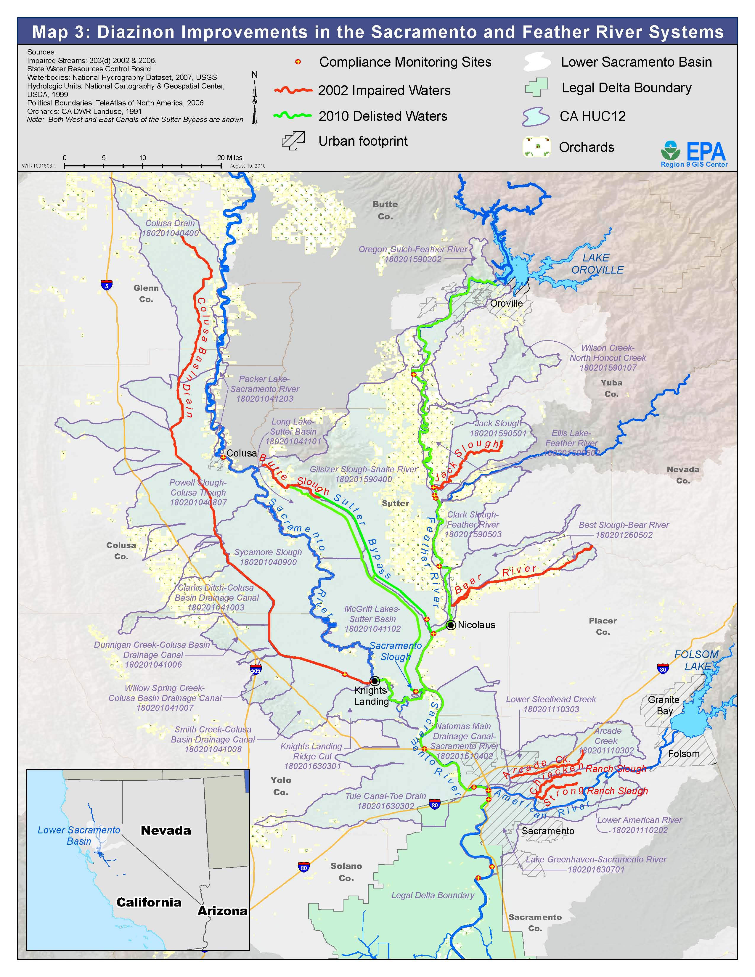
English: This file represents compliance monitoring sites, impaired waters and delisted waters with references to which is what in the legend up top. It is a map of some of Northern California's Sacramento River water system and represents water quality improvement through reduction of diazinon. |
| Date | |
| Source | https://www.epa.gov/sites/default/files/2013-06/feather-sac-improvements-map.jpg |
| Author | State Water Resources Control Board |
Licensing
This image (or other media) is a work of an Environmental Protection Agency employee, taken or made as part of that person's official duties. As works of the U.S. federal government, all EPA images are in the public domain.
|
||
File history
Click on a date/time to view the file as it appeared at that time.
| Date/Time | Thumbnail | Dimensions | User | Comment | |
|---|---|---|---|---|---|
| current | 01:52, 13 May 2022 | | 960 × 1,242 (269 KB) | wikimediacommons>Adam1996M | Uploaded a work by State Water Resources Control Board from https://www.epa.gov/sites/default/files/2013-06/feather-sac-improvements-map.jpg with UploadWizard |
File usage
The following page uses this file: