File:Supervolcano World Map.png
Jump to navigation
Jump to search
Size of this preview: 800 × 406 pixels. Other resolutions: 320 × 163 pixels | 640 × 325 pixels | 1,024 × 520 pixels | 1,992 × 1,012 pixels.
Original file (1,992 × 1,012 pixels, file size: 224 KB, MIME type: image/png)
Summary
| Description |
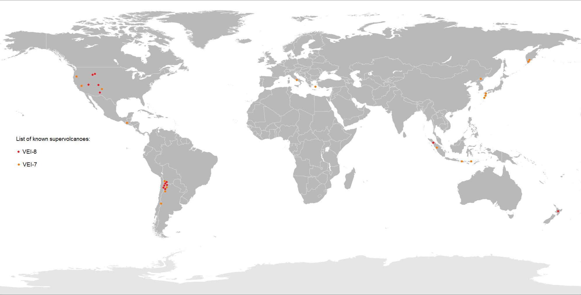
English: Map of known supervolcanoes around the World.
|
| Date | |
| Source | Own work |
| Author | Maphobbyist |
Licensing
I, the copyright holder of this work, hereby publish it under the following license:
This file is licensed under the Creative Commons Attribution-Share Alike 4.0 International license.
- You are free:
- to share – to copy, distribute and transmit the work
- to remix – to adapt the work
- Under the following conditions:
- attribution – You must give appropriate credit, provide a link to the license, and indicate if changes were made. You may do so in any reasonable manner, but not in any way that suggests the licensor endorses you or your use.
- share alike – If you remix, transform, or build upon the material, you must distribute your contributions under the same or compatible license as the original.
File history
Click on a date/time to view the file as it appeared at that time.
| Date/Time | Thumbnail | Dimensions | User | Comment | |
|---|---|---|---|---|---|
| current | 19:20, 23 December 2025 | | 1,992 × 1,012 (224 KB) | wikimediacommons>LightandDark2000 | Added the Independence Dike Swarm linear fissure array supervolcano, which unleashed 4,000 cubic miles (17,000 cubic km) of volcanic material during its supereruption. |
File usage
The following page uses this file: