File:Swisstopo Matterhorn.jpg
Jump to navigation
Jump to search
Size of this preview: 630 × 600 pixels. Other resolutions: 252 × 240 pixels | 504 × 480 pixels | 807 × 768 pixels | 1,076 × 1,024 pixels | 2,152 × 2,048 pixels | 3,174 × 3,021 pixels.
Original file (3,174 × 3,021 pixels, file size: 9.49 MB, MIME type: image/jpeg)
Summary
| Description |
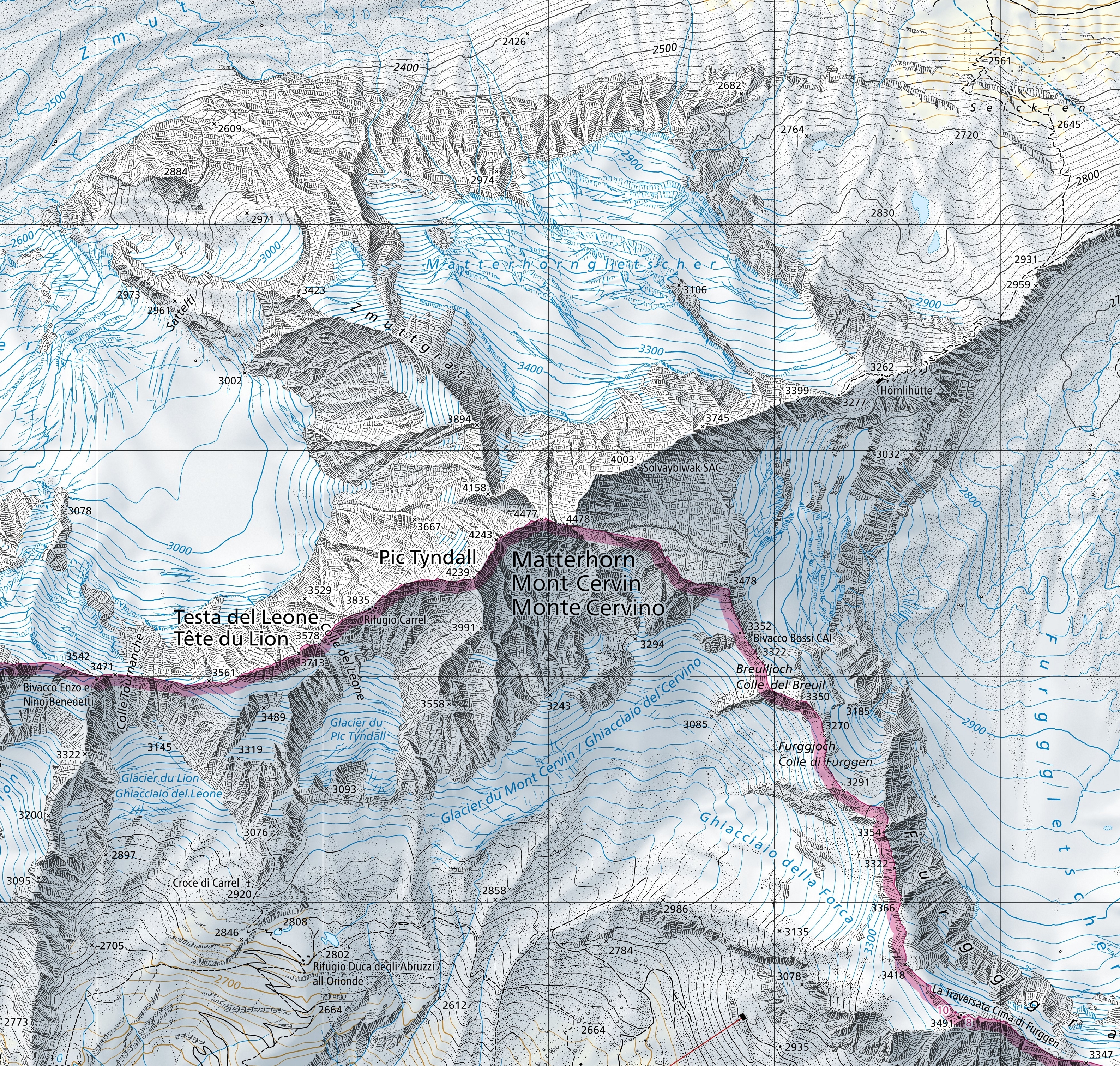
English: Extract of the 1:25'000 national map (1347 Matterhorn). The map is centered on the Matterhorn and shows the international border between Switzerland and Italy (in magenta). Full version can be consulted on the geographical portal. |
||||||||||||||||||||||||||
| Date | |||||||||||||||||||||||||||
| Source |
|
||||||||||||||||||||||||||
| Author |
|
||||||||||||||||||||||||||

Licensing
The data made publicly available by swisstopo may be used, distributed and made accessible. Furthermore, they may be enriched and processed and also used commercially. A reference to the source is mandatory. In the case of digital or analogue representations and publications, as well as in the case of dissemination, one of the following source references must be attached in any case:
Terms of use for free geodata and geoservices (OGD) from swisstopo
|
.svg) |
File history
Click on a date/time to view the file as it appeared at that time.
| Date/Time | Thumbnail | Dimensions | User | Comment | |
|---|---|---|---|---|---|
| current | 11:58, 20 March 2021 | | 3,174 × 3,021 (9.49 MB) | wikimediacommons>Zacharie Grossen | Uploaded a work by Bundesamt für Landestopografie swisstopo from [https://www.swisstopo.admin.ch/en/geodata/maps/smr/smr25.html swisstopo] with UploadWizard |
File usage
The following page uses this file: