File:Txu-oclc-10552568-ng50-15.jpg
Jump to navigation
Jump to search

Size of this preview: 787 × 599 pixels. Other resolutions: 315 × 240 pixels | 630 × 480 pixels | 1,009 × 768 pixels | 1,280 × 975 pixels | 2,560 × 1,950 pixels | 5,000 × 3,808 pixels.
Original file (5,000 × 3,808 pixels, file size: 5.91 MB, MIME type: image/jpeg)
Summary
| Description |
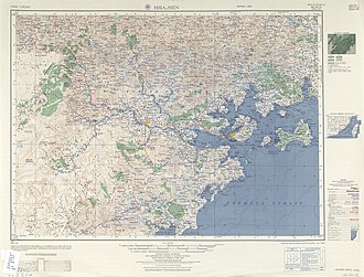
English: Map of Amoy and Surroundings 1954 |
| Date | |
| Source | Courtesy of the University of Texas Libraries, The University of Texas at Austin. (NG 50-15, Archived) |
| Author | Army Map Service (PV), Corps of Engineers 1954 |
| Other versions |
|
.jpg)


-
 Index Map

Licensing
This image or file is a work of a U.S. Army Corps of Engineers soldier or employee, taken or made as part of that person's official duties. As a work of the U.S. federal government, the image is in the public domain.
|
| Annotations | This image is annotated: View the annotations at Commons |
File history
Click on a date/time to view the file as it appeared at that time.
| Date/Time | Thumbnail | Dimensions | User | Comment | |
|---|---|---|---|---|---|
| current | 21:09, 22 March 2015 | | 5,000 × 3,808 (5.91 MB) | wikimediacommons>UnderscoreK | User created page with UploadWizard |
File usage
The following 2 pages use this file: