File:Txu-oclc-6614368-nk51-12a.jpg
Jump to navigation
Jump to search
Size of this preview: 796 × 600 pixels. Other resolutions: 319 × 240 pixels | 637 × 480 pixels | 1,020 × 768 pixels | 1,280 × 964 pixels | 2,560 × 1,928 pixels | 3,850 × 2,900 pixels.
Original file (3,850 × 2,900 pixels, file size: 1.84 MB, MIME type: image/jpeg)
Summary
| Description |
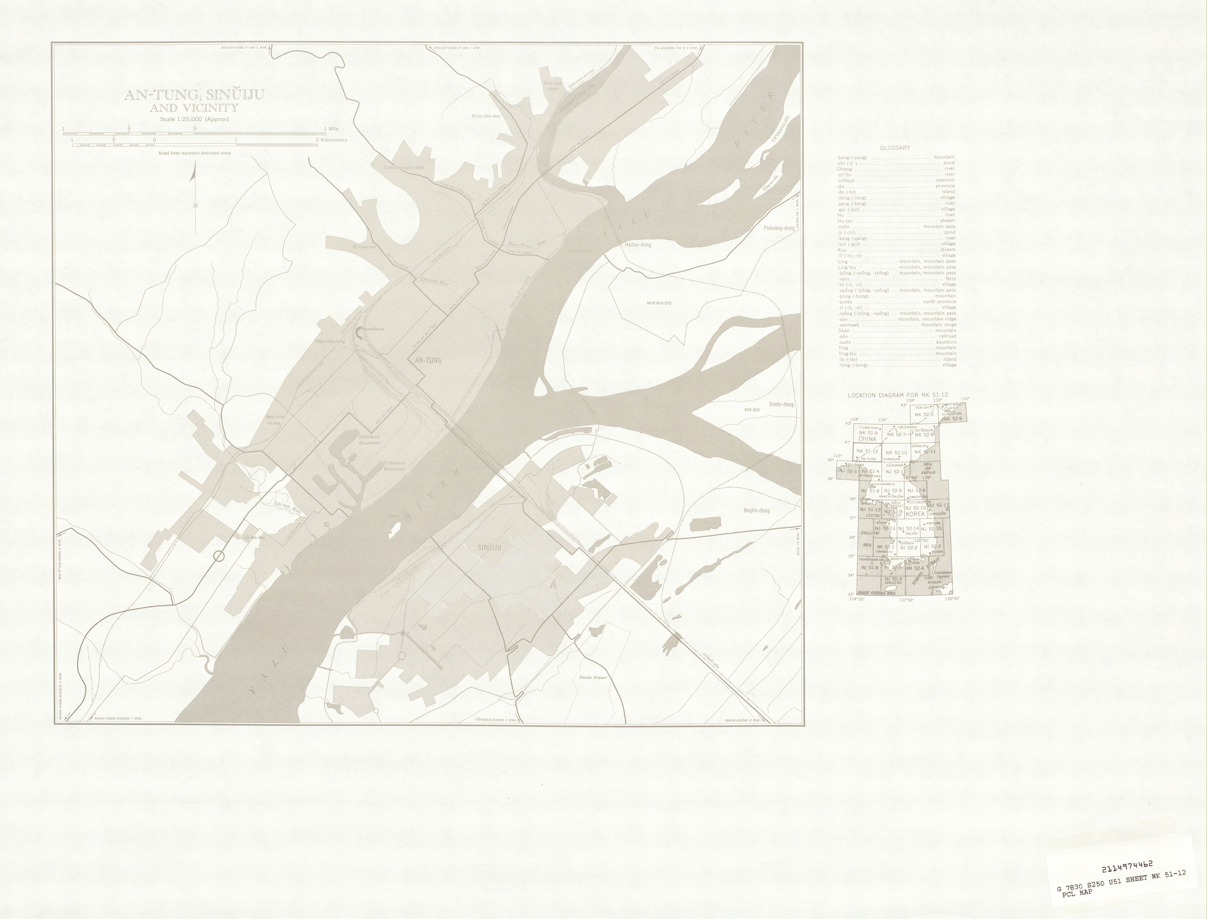
English: Manchuria AMS Topographic Maps - [Code: 2114974462 G 7830 S250 U54 Sheet NG 51-12 PCL MAP] |
| Date | 1950s |
| Source | http://legacy.lib.utexas.edu/maps/ams/manchuria/ |
| Author | Army Map Serivce, Corps of Engineers |
Licensing
This image or file is a work of a U.S. Army Corps of Engineers soldier or employee, taken or made as part of that person's official duties. As a work of the U.S. federal government, the image is in the public domain.
|
File history
Click on a date/time to view the file as it appeared at that time.
| Date/Time | Thumbnail | Dimensions | User | Comment | |
|---|---|---|---|---|---|
| current | 22:27, 9 August 2025 | | 3,850 × 2,900 (1.84 MB) | wikimediacommons>Enyavar | Cropped 23 % horizontally, 24 % vertically, 41 % areawise using CropTool with precise mode. |