File:UA232map.png
Jump to navigation
Jump to search
Size of this preview: 800 × 581 pixels. Other resolutions: 320 × 232 pixels | 640 × 465 pixels | 1,024 × 744 pixels | 1,280 × 929 pixels | 2,567 × 1,864 pixels.
Original file (2,567 × 1,864 pixels, file size: 60 KB, MIME type: image/png)
Summary
| Description |
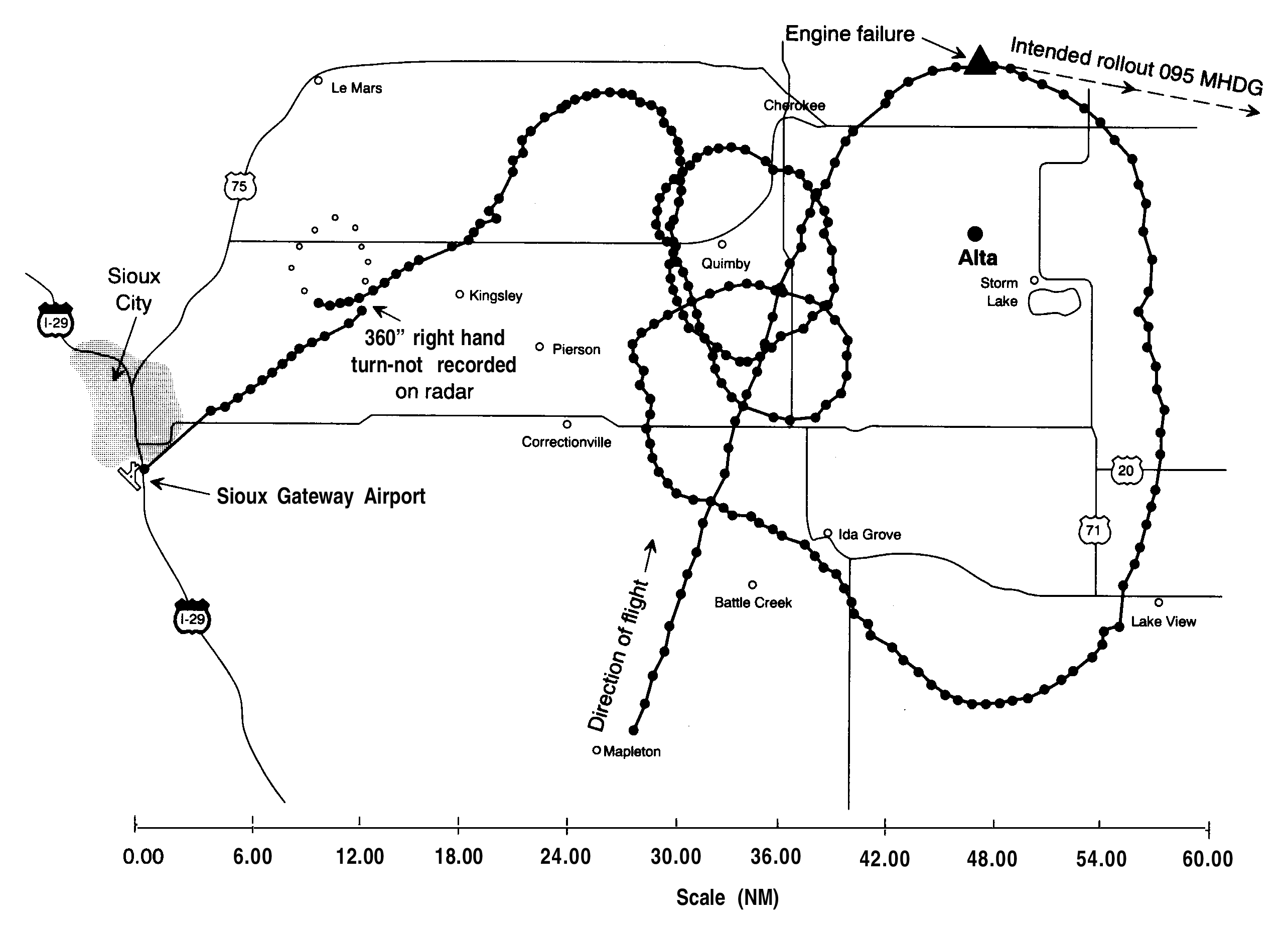
English: A radar map from the NTSB report into United Airlines Flight 232 crash. This shows all the known radar locations of the DC10 involved before its crash landing at Sioux Gateway Airport. |
| Date | |
| Source | NTSB accident report |
| Author | NTSB |

|
This map image could be re-created using vector graphics as an SVG file. This has several advantages; see Commons:Media for cleanup for more information. If an SVG form of this image is available, please upload it and afterwards replace this template with
{{vector version available|new image name}}.It is recommended to name the SVG file “UA232map.svg”—then the template Vector version available (or Vva) does not need the new image name parameter. |
Licensing
This image is a work of a National Transportation Safety Board employee, taken or made as part of an employee's official duties. As a work of the U.S. federal government, all NTSB images are in the public domain in the United States.
|
Original upload log
Transferred from en.wikipedia to Commons by Atmoz using CommonsHelper.
The original description page was here. All following user names refer to en.wikipedia.
- 2006-09-06 14:39 John 1005×702× (29356 bytes) Radar map from NTSB report into UA 232 crash
File history
Click on a date/time to view the file as it appeared at that time.
| Date/Time | Thumbnail | Dimensions | User | Comment | |
|---|---|---|---|---|---|
| current | 00:16, 3 September 2017 | | 2,567 × 1,864 (60 KB) | wikimediacommons>Mikhail Ryazanov | original resolution from PDF |
File usage
The following page uses this file: