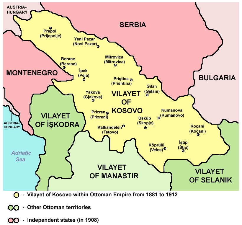
File:Vilayet of Kosovo (1881–1912) map.png
Jump to navigation
Jump to search
Size of this preview: 645 × 599 pixels. Other resolutions: 258 × 240 pixels | 517 × 480 pixels | 820 × 762 pixels.
Original file (820 × 762 pixels, file size: 74 KB, MIME type: image/png)
_map.png)
Summary
VILAJETI I KOSOVËS NËN PERANDORINË OSMANE NGA 1881 DERI MË 1912
Source and licence

|
This map has been uploaded by Electionworld from en.wikipedia.org to enable the |
| This work has been released into the public domain by its author, PANONIAN. This applies worldwide. In some countries this may not be legally possible; if so: |
References
Main reference:
- Created according to historical map from this book: Petrit Imami, Srbi i Albanci kroz vekove, Beograd, 2000.
Secondary references with similar maps:
- Noel Malcolm, Kosovo - A Short History, Pan Books, London, 2002.
- Školski istorijski atlas, Zavod za izdavanje udžbenika SR Srbije, Beograd, 1970.
- Sve srpske mape - od šestog veka do Pariza, Specijalno izdanje BLICA, Decembar 1995. godine.
- http://terkepek.adatbank.transindex.ro/kepek/netre/95.gif archive copy at the Wayback Machine
- http://www.panmacedonian.info/macedonism_thesis_files/Macedonism%20of%20the%20Slavs_img_19.jpg[dead link]
- http://www.zum.de/whkmla/histatlas/balkans/rumelia1891t.gif
- http://www.kosovo.net/sk/rastko-kosovo/istorija/kosovo_chronicles/kc_figure1.gif
- http://www.hri.org/docs/macque/map3.gif
- http://remmm.revues.org/docannexe/image/305/img-1-small480.png
- http://www.cairn.info/loadimg.php?FILE=GMCC/GMCC_202/GMCC_202_0113/fullGMCC_id9782130527213_pu2001-02d_pa01-da16_art07_img001.jpg
File history
Click on a date/time to view the file as it appeared at that time.
| Date/Time | Thumbnail | Dimensions | User | Comment | |
|---|---|---|---|---|---|
| current | 13:16, 11 September 2012 | | 820 × 762 (74 KB) | wikimediacommons>WikiEditor2004 | {{Information |Description ={{en|1=cosmetic changes}} |Source =cosmetic changes |Author =cosmetic changes |Date = |Permission = |other_versions = }} |
File usage
No pages on the English Wikipedia use this file (pages on other projects are not listed).
_map.png)