File:Wales Administrative Map 2009.png
Jump to navigation
Jump to search
Size of this preview: 380 × 599 pixels. Other resolutions: 152 × 240 pixels | 304 × 480 pixels | 487 × 768 pixels | 649 × 1,024 pixels | 2,150 × 3,389 pixels.
Original file (2,150 × 3,389 pixels, file size: 1.09 MB, MIME type: image/png)
Summary
| Description |
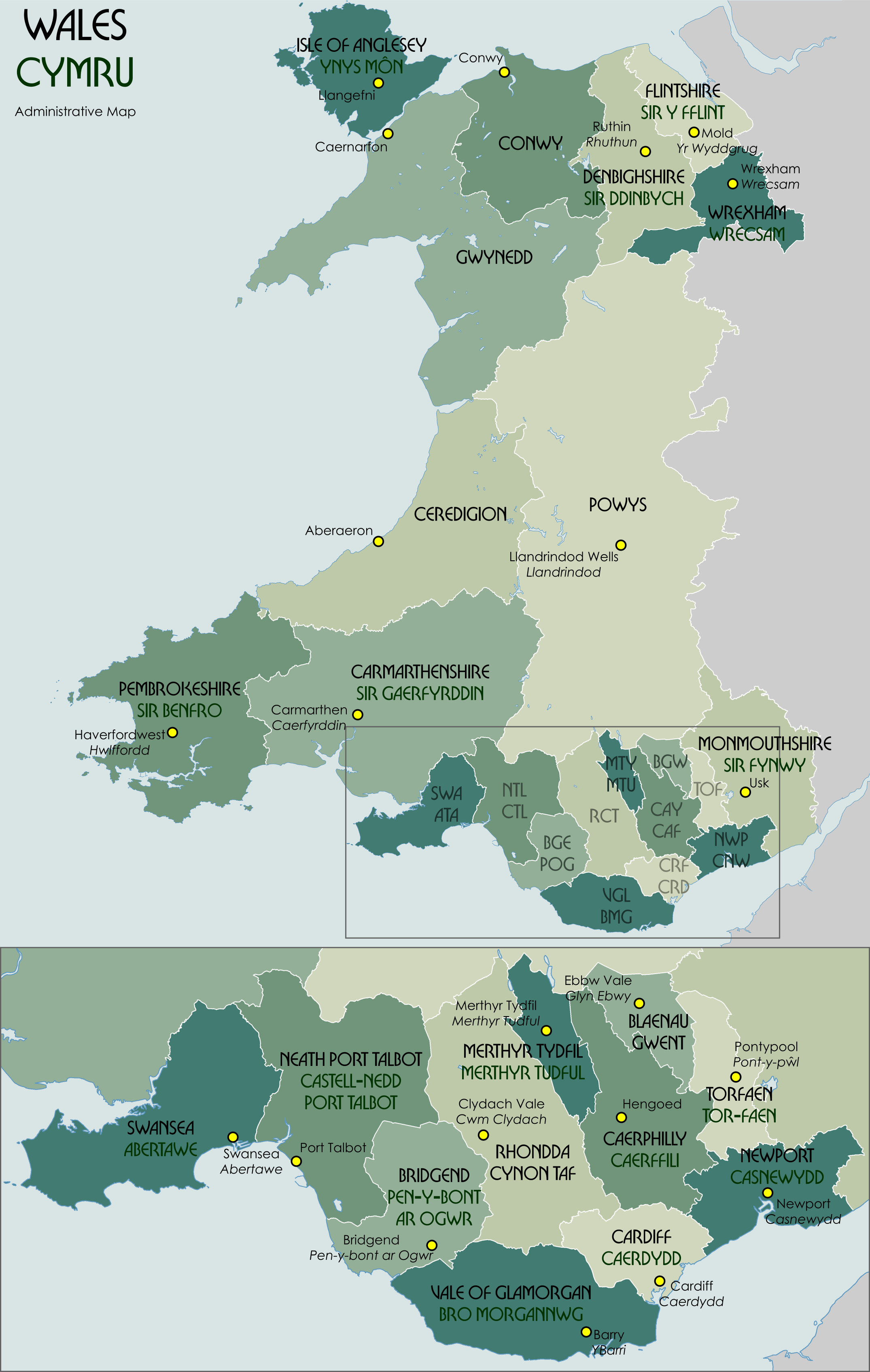
English: Administrative map showing the unitary authorities of Wales and their administrative HQs. |
| Date | |
| Source | Own work |
| Author | XrysD |
Code for clickable map

Licensing
I, the copyright holder of this work, hereby publish it under the following license:

|
Permission is granted to copy, distribute and/or modify this document under the terms of the GNU Free Documentation License, Version 1.2 or any later version published by the Free Software Foundation; with no Invariant Sections, no Front-Cover Texts, and no Back-Cover Texts. A copy of the license is included in the section entitled GNU Free Documentation License. |
File history
Click on a date/time to view the file as it appeared at that time.
| Date/Time | Thumbnail | Dimensions | User | Comment | |
|---|---|---|---|---|---|
| current | 12:33, 30 November 2021 | | 2,150 × 3,389 (1.09 MB) | wikimediacommons>XrysD | Correct version |
File usage
The following page uses this file: