File:West Prussia Physical Map.png
Jump to navigation
Jump to search
Size of this preview: 718 × 600 pixels. Other resolutions: 287 × 240 pixels | 575 × 480 pixels | 920 × 768 pixels | 1,226 × 1,024 pixels | 2,452 × 2,048 pixels | 9,579 × 8,001 pixels.
Original file (9,579 × 8,001 pixels, file size: 62.32 MB, MIME type: image/png)
Summary
| Description |
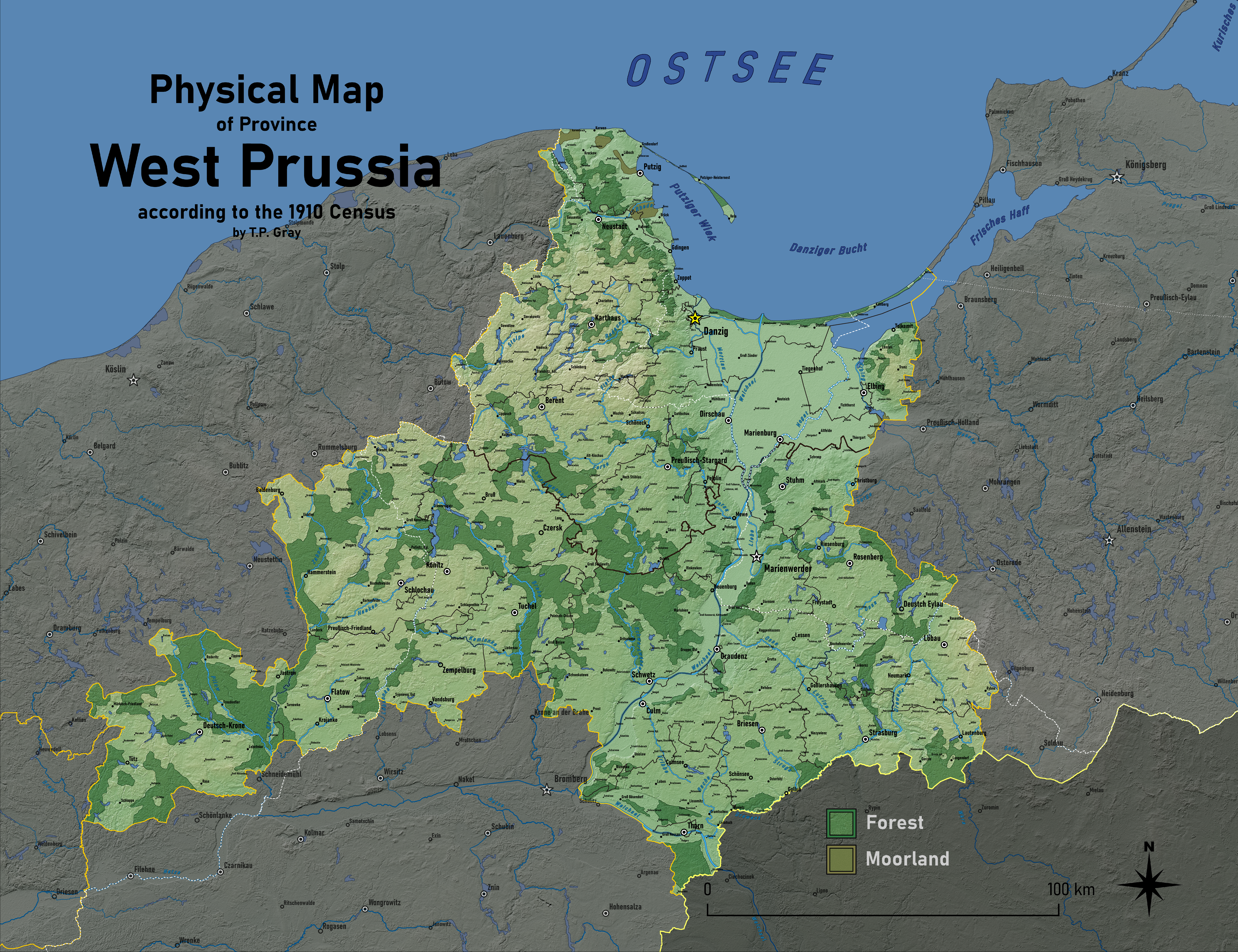
English: Physical map of West Prussia in 1905, with cities and towns, political boundaries, rivers and water-bodies, and forests/moorlands indicated.
SRTM data for relief and topography from from U.S. Geological Survey, National Geospatial Program. |
| Date | |
| Source | Own work |
| Author | Ascended Dreamer |
Licensing
I, the copyright holder of this work, hereby publish it under the following license:
This file is licensed under the Creative Commons Attribution-Share Alike 4.0 International license.
- You are free:
- to share – to copy, distribute and transmit the work
- to remix – to adapt the work
- Under the following conditions:
- attribution – You must give appropriate credit, provide a link to the license, and indicate if changes were made. You may do so in any reasonable manner, but not in any way that suggests the licensor endorses you or your use.
- share alike – If you remix, transform, or build upon the material, you must distribute your contributions under the same or compatible license as the original.
File history
Click on a date/time to view the file as it appeared at that time.
| Date/Time | Thumbnail | Dimensions | User | Comment | |
|---|---|---|---|---|---|
| current | 23:17, 17 March 2026 | | 9,579 × 8,001 (62.32 MB) | wikimediacommons>Ascended Dreamer | Revised Version |
File usage
The following page uses this file: