File:Wood Howe island, Haweswater Reservoir - geograph.org.uk - 301396.jpg
Jump to navigation
Jump to search
No higher resolution available.
Wood_Howe_island,_Haweswater_Reservoir_-_geograph.org.uk_-_301396.jpg (640 × 480 pixels, file size: 66 KB, MIME type: image/jpeg)
Summary
| Description |
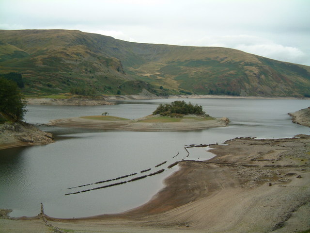
English: Wood Howe island, Haweswater Reservoir. Wood Howe island and ruins of Mardale Green village visible after summer drought of 2003. 'Drystone' wall sides of road can clearly be seen. |
||
| Date | |||
| Source | geograph.org.uk | ||
| Author | John Douglas | ||
| Permission (Reusing this file) |
This file is licensed under the Creative Commons Attribution-Share Alike 2.0 Generic license. Attribution: John Douglas
|
||
| Attribution (required by the license) | John Douglas / Wood Howe island, Haweswater Reservoir / | ||

| Object location | | View this and other nearby images on: OpenStreetMap |
|---|
_heading:0.00&language=en)
File history
Click on a date/time to view the file as it appeared at that time.
| Date/Time | Thumbnail | Dimensions | User | Comment | |
|---|---|---|---|---|---|
| current | 23:00, 22 December 2010 | | 640 × 480 (66 KB) | wikimediacommons>GeographBot | == {{int:filedesc}} == {{Information |description={{en|1=Wood Howe island, Haweswater Reservoir Wood Howe island and ruins of Mardale Green village visible after summer drought of 2003. 'Drystone' wall sides of road can clearly be seen.}} |date=2003-09-19 |
File usage
The following page uses this file: