File:World Map 1689.JPG
Jump to navigation
Jump to search

Size of this preview: 695 × 600 pixels. Other resolutions: 278 × 240 pixels | 556 × 480 pixels | 890 × 768 pixels | 1,186 × 1,024 pixels | 2,373 × 2,048 pixels | 4,560 × 3,936 pixels.
Original file (4,560 × 3,936 pixels, file size: 8.59 MB, MIME type: image/jpeg)
|

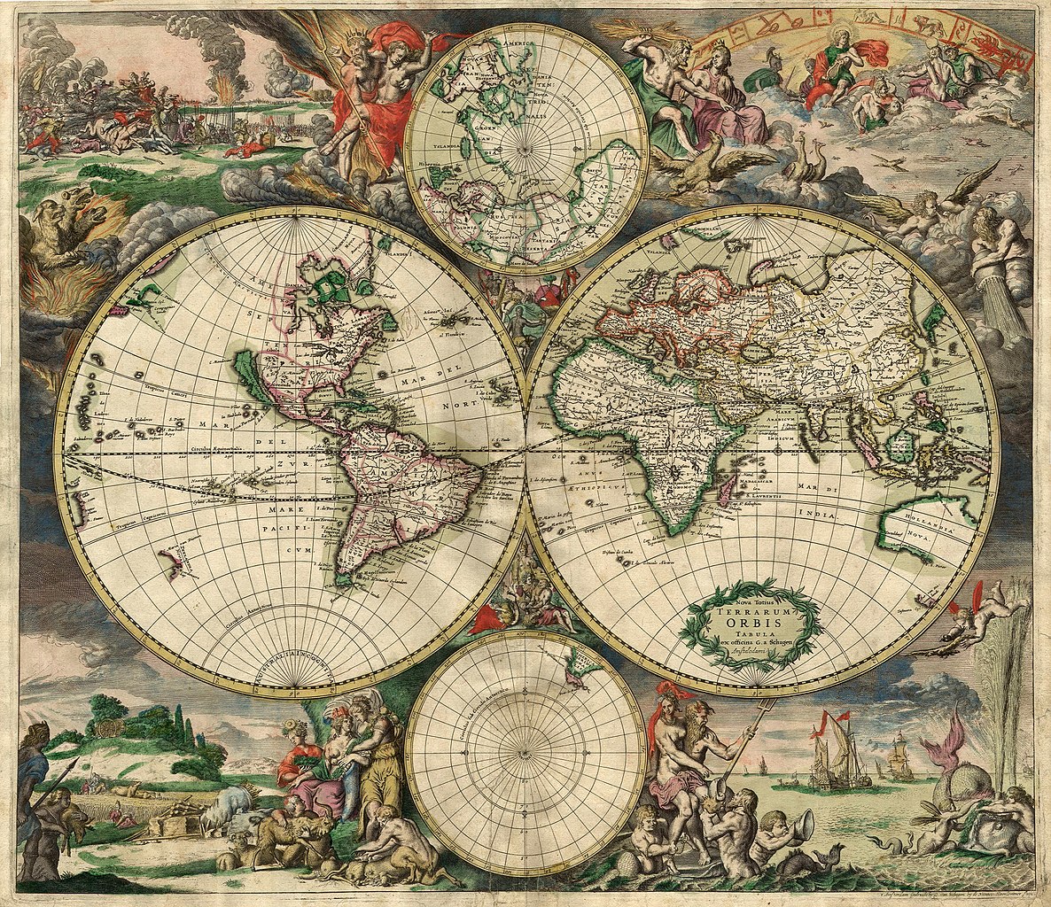
This image was selected as picture of the day on Wikimedia Commons for 7 February 2007. It was captioned as follows: English: An old world map produced in Amsterdam in 1689. Other languages:
Deutsch: Eine 1689 in Amsterdam hergestellte Weltkarte. English: An old world map produced in Amsterdam in 1689. Polski: Mapa świata wyprodukowana w Amsterdamie w roku 1689. Suomi: Hollantilainen maailmankartta vuodelta 1689 Svenska: En gammal världskarta tillverkad i Amsterdam 1689. Winaray: In kahadto nga mapa han kalibutan nga ginhimo ha Amsterdam, 1689. Српски / srpski: Стара карта света направљена у Амстердаму 1689. עברית : מפת עולם משנת 1689 מאמסטרדם |
| This image was selected as a picture of the week on the Persian Wikipedia for the 21st week, 2011. |
Summary
| Description |
Nederlands: Nova totius terrarum orbis tabula Amstelodami, ex officina G. a Schagen (1682), t'Amsterdam Gedruckt by G. van Schagen, by de Nieuwe Haerlemmer Sluys.
English: World map - Produced in Amsterdam
First edition : 1689. Original size : 48.3 x 56.0 cm. Produced using copper engraving. Extremely rare set of maps, only known in one other example in the Amsterdam University. No copies in American libraries. In original hand color. Français : Carte du monde - Créée à Amsterdam Première édition : 1689. Taille originale : 48,3 x 56,0 cm. Eau forte. |
| Date | This edition 1689 |
| Source | This image is made up of six separate images downloaded from Helmink.com and stitched together. |
| Creator | |
| Georeferencing | If inappropriate please set warp_status = skip to hide. |
| Other versions | Image:World Map 1689-smaller.jpg (smaller filesize version, easier to download) |
.JPG)
Licensing
|
This work is in the public domain in its country of origin and other countries and areas where the copyright term is the author's life plus 70 years or fewer. | |
| This file has been identified as being free of known restrictions under copyright law, including all related and neighboring rights. | |
File history
Click on a date/time to view the file as it appeared at that time.
| Date/Time | Thumbnail | Dimensions | User | Comment | |
|---|---|---|---|---|---|
| current | 00:59, 4 September 2013 | | 4,560 × 3,936 (8.59 MB) | wikimediacommons>Crisco 1492 | Reverted to version as of 12:34, 16 October 2010 |
File usage
The following page uses this file: