File:Yazoo river.gif
Jump to navigation
Jump to search
Size of this preview: 477 × 599 pixels. Other resolutions: 191 × 240 pixels | 382 × 480 pixels | 776 × 975 pixels.
Original file (776 × 975 pixels, file size: 46 KB, MIME type: image/gif)
| Description |
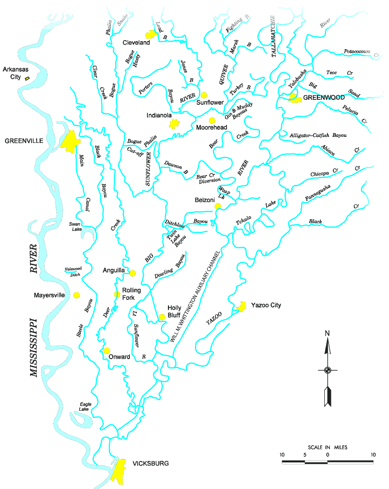
Map of the Yazoo River watershed — located in Mississippi.
|
|||
| Source |
http://www.mvk.usace.army.mil/offices/pp/projects/yazoobackwater/docs/01app4.pdf[dead link] |
|||
| Author | ||||
| Permission (Reusing this file) |
|
File history
Click on a date/time to view the file as it appeared at that time.
| Date/Time | Thumbnail | Dimensions | User | Comment | |
|---|---|---|---|---|---|
| current | 19:19, 19 November 2006 | | 776 × 975 (46 KB) | wikimediacommons>PhilFree | Yazoo River, USA. The image uploaded is modified from the original created by U. S. Army Corps of Engineers' Vicksburg District ([http://www.mvk.usace.army.mil/offices/pp/projects/yazoobackwater/docs/01app4.pdf Yazoo Backwater Reformulation Report (pdf)]) |
File usage
The following page uses this file: