Maardu
Template:Short description Template:About Template:Expand Estonian Template:More citations needed
Template:Main other{{#invoke:Infobox|infobox}}Template:Template other{{#invoke:Check for unknown parameters|check|unknown=Template:Main other|preview = Page using [[Template:Template:If empty]] with unknown parameter "_VALUE_"|ignoreblank=y|mapframe_args=y | alt | anthem | anthem_link | area_blank1_acre | area_blank1_dunam | area_blank1_ha | area_blank1_km2 | area_blank1_sq_mi | area_blank1_title | area_blank2_acre | area_blank2_dunam | area_blank2_ha | area_blank2_km2 | area_blank2_sq_mi | area_blank2_title | area_code | area_code_type | area_codes | area_footnotes | area_land_acre | area_land_dunam | area_land_ha | area_land_km2 | area_land_sq_mi | area_metro_acre | area_metro_dunam | area_metro_footnotes | area_metro_ha | area_metro_km2 | area_metro_sq_mi | area_note | area_rank | area_rural_acre | area_rural_dunam | area_rural_footnotes | area_rural_ha | area_rural_km2 | area_rural_sq_mi | area_total_acre | area_total_dunam | area_total_ha | area_total_km2 | area_total_sq_mi | area_urban_acre | area_urban_dunam | area_urban_footnotes | area_urban_ha | area_urban_km2 | area_urban_sq_mi | area_water_acre | area_water_dunam | area_water_ha | area_water_km2 | area_water_percent | area_water_sq_mi | blank_emblem_alt | blank_emblem_link | blank_emblem_size | blank_emblem_type | blank_emblem_sizedefault | blank_emblem_upright | blank_info | blank_info_sec1 | blank_info_sec2 | blank_name | blank_name_sec1 | blank_name_sec2 | blank1_info | blank1_info_sec1 | blank1_info_sec2 | blank1_name | blank1_name_sec1 | blank1_name_sec2 | blank2_info | blank2_info_sec1 | blank2_info_sec2 | blank2_name | blank2_name_sec1 | blank2_name_sec2 | blank3_info | blank3_info_sec1 | blank3_info_sec2 | blank3_name | blank3_name_sec1 | blank3_name_sec2 | blank4_info | blank4_info_sec1 | blank4_info_sec2 | blank4_name | blank4_name_sec1 | blank4_name_sec2 | blank5_info | blank5_info_sec1 | blank5_info_sec2 | blank5_name | blank5_name_sec1 | blank5_name_sec2 | blank6_info | blank6_info_sec1 | blank6_info_sec2 | blank6_name | blank6_name_sec1 | blank6_name_sec2 | blank7_info | blank7_info_sec1 | blank7_info_sec2 | blank7_name | blank7_name_sec1 | blank7_name_sec2 | caption | code1_info | code1_name | code2_info | code2_name | coor_pinpoint | coor_type | coordinates | coordinates_footnotes | demographics_type1 | demographics_type2 | demographics1_footnotes | demographics1_info1 | demographics1_info10 | demographics1_info2 | demographics1_info3 | demographics1_info4 | demographics1_info5 | demographics1_info6 | demographics1_info7 | demographics1_info8 | demographics1_info9 | demographics1_title1 | demographics1_title10 | demographics1_title2 | demographics1_title3 | demographics1_title4 | demographics1_title5 | demographics1_title6 | demographics1_title7 | demographics1_title8 | demographics1_title9 | demographics2_footnotes | demographics2_info1 | demographics2_info10 | demographics2_info2 | demographics2_info3 | demographics2_info4 | demographics2_info5 | demographics2_info6 | demographics2_info7 | demographics2_info8 | demographics2_info9 | demographics2_title1 | demographics2_title10 | demographics2_title2 | demographics2_title3 | demographics2_title4 | demographics2_title5 | demographics2_title6 | demographics2_title7 | demographics2_title8 | demographics2_title9 | dimensions_footnotes | dunam_link | elevation_footnotes | elevation_ft | elevation_link | elevation_m | elevation_max_footnotes | elevation_max_ft | elevation_max_m | elevation_max_point | elevation_max_rank | elevation_min_footnotes | elevation_min_ft | elevation_min_m | elevation_min_point | elevation_min_rank | elevation_point | embed | established_date | established_date1 | established_date2 | established_date3 | established_date4 | established_date5 | established_date6 | established_date7 | established_title | established_title1 | established_title2 | established_title3 | established_title4 | established_title5 | established_title6 | established_title7 | etymology | extinct_date | extinct_title | flag_alt | flag_border | flag_link | flag_size | footnotes | founder | geocode | governing_body | government_footnotes | government_type | government_blank1_title | government_blank1 | government_blank2_title | government_blank2 | government_blank2_title | government_blank3 | government_blank3_title | government_blank3 | government_blank4_title | government_blank4 | government_blank5_title | government_blank5 | government_blank6_title | government_blank6 | grid_name | grid_position | image_alt | image_blank_emblem | image_caption | image_flag | image_map | image_map1 | image_seal | image_shield | image_size | image_skyline | imagesize | image_sizedefault | image_upright | iso_code | leader_name | leader_name1 | leader_name2 | leader_name3 | leader_name4 | leader_name5 | leader_party | leader_title | leader_title1 | leader_title2 | leader_title3 | leader_title4 | leader_title5 | length_km | length_mi | map_alt | map_alt1 | map_caption | map_caption1 | mapsize | mapsize1 | module | motto | motto_link | mottoes | name | named_for | native_name | native_name_lang | nickname | nickname_link | nicknames | official_name | other_name | p1 | p10 | p11 | p12 | p13 | p14 | p15 | p16 | p17 | p18 | p19 | p2 | p20 | p21 | p22 | p23 | p24 | p25 | p26 | p27 | p28 | p29 | p3 | p30 | p31 | p32 | p33 | p34 | p35 | p36 | p37 | p38 | p39 | p4 | p40 | p41 | p42 | p43 | p44 | p45 | p46 | p47 | p48 | p49 | p5 | p50 | p6 | p7 | p8 | p9 | parts | parts_style | parts_type | pop_est_as_of | pop_est_footnotes | population | population_as_of | population_blank1 | population_blank1_footnotes | population_blank1_title | population_blank2 | population_blank2_footnotes | population_blank2_title | population_demonym | population_demonyms | population_density_blank1_km2 | population_density_blank1_sq_mi | population_density_blank2_km2 | population_density_blank2_sq_mi | population_density_km2 | population_density_metro_km2 | population_density_metro_sq_mi | population_density_rank | population_density_rural_km2 | population_density_rural_sq_mi | population_density_sq_mi | population_density_urban_km2 | population_density_urban_sq_mi | population_est | population_footnotes | population_metro | population_metro_footnotes | population_note | population_rank | population_rural | population_rural_footnotes | population_total | population_urban | population_urban_footnotes | postal_code | postal_code_type | postal2_code | postal2_code_type | pushpin_image | pushpin_label | pushpin_label_position | pushpin_map | pushpin_map_alt | pushpin_map_caption | pushpin_map_caption_notsmall | pushpin_map_narrow | pushpin_mapsize | pushpin_outside | pushpin_overlay | pushpin_relief | registration_plate | registration_plate_type | seal_alt | seal_link | seal_size | seal_type | seat | seat_type | seat1 | seat1_type | seat2 | seat2_type | settlement_type | shield_alt | shield_link | shield_size | short_description | subdivision_name | subdivision_name1 | subdivision_name2 | subdivision_name3 | subdivision_name4 | subdivision_name5 | subdivision_name6 | subdivision_type | subdivision_type1 | subdivision_type2 | subdivision_type3 | subdivision_type4 | subdivision_type5 | subdivision_type6 | template_name | timezone | timezone_DST | timezone_link | timezone1 | timezone1_DST | timezone1_location | timezone2 | timezone2_DST | timezone2_location | timezone3 | timezone3_DST | timezone3_location | timezone4 | timezone4_DST | timezone4_location | timezone5 | timezone5_DST | timezone5_location | total_type | translit_lang1 | translit_lang1_info | translit_lang1_info1 | translit_lang1_info2 | translit_lang1_info3 | translit_lang1_info4 | translit_lang1_info5 | translit_lang1_info6 | translit_lang1_type | translit_lang1_type1 | translit_lang1_type2 | translit_lang1_type3 | translit_lang1_type4 | translit_lang1_type5 | translit_lang1_type6 | translit_lang2 | translit_lang2_info | translit_lang2_info1 | translit_lang2_info2 | translit_lang2_info3 | translit_lang2_info4 | translit_lang2_info5 | translit_lang2_info6 | translit_lang2_type | translit_lang2_type1 | translit_lang2_type2 | translit_lang2_type3 | translit_lang2_type4 | translit_lang2_type5 | translit_lang2_type6 | type | unit_pref | utc_offset | utc_offset_DST | utc_offset1 | utc_offset1_DST | utc_offset2 | utc_offset2_DST | utc_offset3 | utc_offset3_DST | utc_offset4 | utc_offset4_DST | utc_offset5 | utc_offset5_DST | website | width_km | width_mi }}{{#invoke:Check for clobbered parameters|check | template = [[Template:Template:If empty]] | cat = Template:Main other | population; population_total | image_size; imagesize | image_alt; alt | image_caption; caption | settlement_type; type | utc_offset1; utc_offset | timezone1; timezone }}{{#if:
|
}}Template:Main other{{#ifexpr:{{#invoke:ParameterCount|main|mapframe|image_map|image_map1|pushpin_map}} >2 |Template:Main other}}
Maardu ({{#invoke:IPA|main}}, Template:Langx) is a town and a municipality in Harju County, Estonia. It is part of Tallinn metropolitan area, located about Template:Convert east of the capital city.<ref name="about">{{#invoke:citation/CS1|citation |CitationClass=web }}</ref> The town covers an area of 22.76 km2 and has a population of 16,170 (as of 1 January 2021).<ref name=population />
The Port of Muuga, the largest cargo port in Estonia, is partly located in Maardu.<ref>{{#invoke:citation/CS1|citation |CitationClass=web }}</ref>
According to the 2000 Census, the population was 16,738. 61.7% were Russians, 19.9% Estonians, 6.6% Ukrainians, 5.7% Belarusians, 1.5% Tatars. The proportion of Estonians was one of the lowest (if not the lowest) in Central and Western Estonia.
Outside the town (in the village of Maardu), south of the road to Narva lies Maardu manor, one of the oldest preserved baroque manor houses in Estonia. It traces its origins to 1389, but the current building dates from the 1660s with additions made in the 19th century. The landlord of the manor Herman Jensen Bohn in 1739 funded the printing of the first bible printed in Estonian.<ref>Template:Cite book</ref>
Maardu neighborhoods
Maardu may be divided into six parts:
- Kallavere (the centre of the city where most of the public institutions are located)
- Muuga Harbour
- Muuga aedlinn (former garden city, now a light residential suburb more connected to Tallinn than Kallavere)
- Kärmu (industrial area)
- Kroodi (industrial area)
- Lake Maardu
Demographics
| Ethnicity | 1959<ref>Template:Cite book</ref> | 1970<ref>Template:Cite book</ref> | 1979<ref name=":0">Template:Cite book</ref> | 1989<ref name=":0" /> | 2000<ref>{{#invoke:citation/CS1|citation | CitationClass=web
}}</ref> |
2011<ref>{{#invoke:citation/CS1|citation | CitationClass=web
}}</ref> |
2021<ref>{{#invoke:citation/CS1|citation | CitationClass=web
}}</ref> | |||||||
|---|---|---|---|---|---|---|---|---|---|---|---|---|---|---|---|---|---|
| amount | % | amount | % | amount | % | amount | % | amount | % | amount | % | amount | % | ||||
| Estonians | 1475 | 34.9 | 2110 | 30.7 | 2167 | 21.7 | 2479 | 15.4 | 3331 | 19.9 | 4347 | 24.8 | 3746 | 23.2 | |||
| Russians | - | - | 3254 | 47.3 | 5656 | 56.7 | 10024 | 62.4 | 10331 | 61.7 | 10845 | 61.9 | 10037 | 62.1 | |||
| Ukrainians | - | - | 298 | 4.33 | 584 | 5.86 | 1269 | 7.91 | 1101 | 6.58 | 861 | 4.91 | 957 | 5.92 | |||
| Belarusians | - | - | 763 | 11.1 | 942 | 9.45 | 1281 | 7.98 | 949 | 5.67 | 660 | 3.77 | 536 | 3.31 | |||
| Finns | - | - | 144 | 2.09 | 139 | 1.39 | 133 | 0.83 | 144 | 0.86 | 88 | 0.50 | 62 | 0.38 | |||
| Jews | - | - | 19 | 0.28 | 28 | 0.28 | 24 | 0.15 | 19 | 0.11 | 20 | 0.11 | 13 | 0.08 | |||
| Latvians | - | - | 19 | 0.28 | 27 | 0.27 | 37 | 0.23 | 36 | 0.22 | 34 | 0.19 | 42 | 0.26 | |||
| Germans | - | - | - | - | 27 | 0.27 | 42 | 0.26 | 31 | 0.19 | 27 | 0.15 | 25 | 0.15 | |||
| Tatars | - | - | - | - | 169 | 1.70 | 267 | 1.66 | 245 | 1.46 | 168 | 0.96 | 156 | 0.96 | |||
| Poles | - | - | - | - | 73 | 0.73 | 86 | 0.54 | 93 | 0.56 | 86 | 0.49 | 85 | 0.53 | |||
| Lithuanians | - | - | 24 | 0.35 | 36 | 0.36 | 51 | 0.32 | 79 | 0.47 | 82 | 0.47 | 78 | 0.48 | |||
| unknown | 0 | 0.00 | 0 | 0.00 | 0 | 0.00 | 0 | 0.00 | 93 | 0.56 | 14 | 0.08 | 80 | 0.49 | |||
| other | 2748 | 65.1 | 246 | 3.58 | 122 | 1.22 | 359 | 2.24 | 286 | 1.71 | 292 | 1.67 | 353 | 2.18 | |||
| Total | 4223 | 100 | 6877 | 100 | 9970 | 100 | 16052 | 100 | 16738 | 100 | 17524 | 100 | 16170 | 100 | |||
Gallery
-
 Maardu Archangel Michael Church
 -

-

-
 Maardu manor house
 -
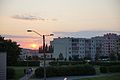 Apartment buildings at sunset
 -
Soviet-era apartment buildings
-
Abandoned factory building in Maardu
-
Kroodi creek


See also
References
External links
Template:Cities of Estonia Template:Harjumaa Template:Authority control